Thank you for your feedback!
Public engagement is now closed. Stay tuned for next steps.
About the Project
We planned new walking and biking routes in several communities, including Marlborough Park, Albert Park Radisson Heights, Penbrooke Meadows, Forest Heights, Forest Lawn, Dover, Southview, and Erin Woods. These areas were chosen because they fit well with Calgary’s existing pathway and bikeway system. The new routes will help people get to their homes, jobs, schools, parks, and other places more easily. Once built, they will give people of all ages and abilities safe and affordable ways to travel all year.
These routes will help reduce traffic safety incidents, help kids get to school safely, and make it easier for people to reach the places they need to go. Records show that these communities had more injuries from collisions between 2017 and 2021. By building safer paths and fixing missing links, everyone will have a safe and comfortable way to move around their neighbourhood.
 We used feedback from earlier phases, along with rules, budget, and technical limits, to create the concept designs we are sharing now.
We also want your thoughts on possibly closing 40 Street SE. A survey is farther down this page. Your answers will help us understand how the community feels about this idea.
You can also read the “What We Did” report here to see why we chose these options.
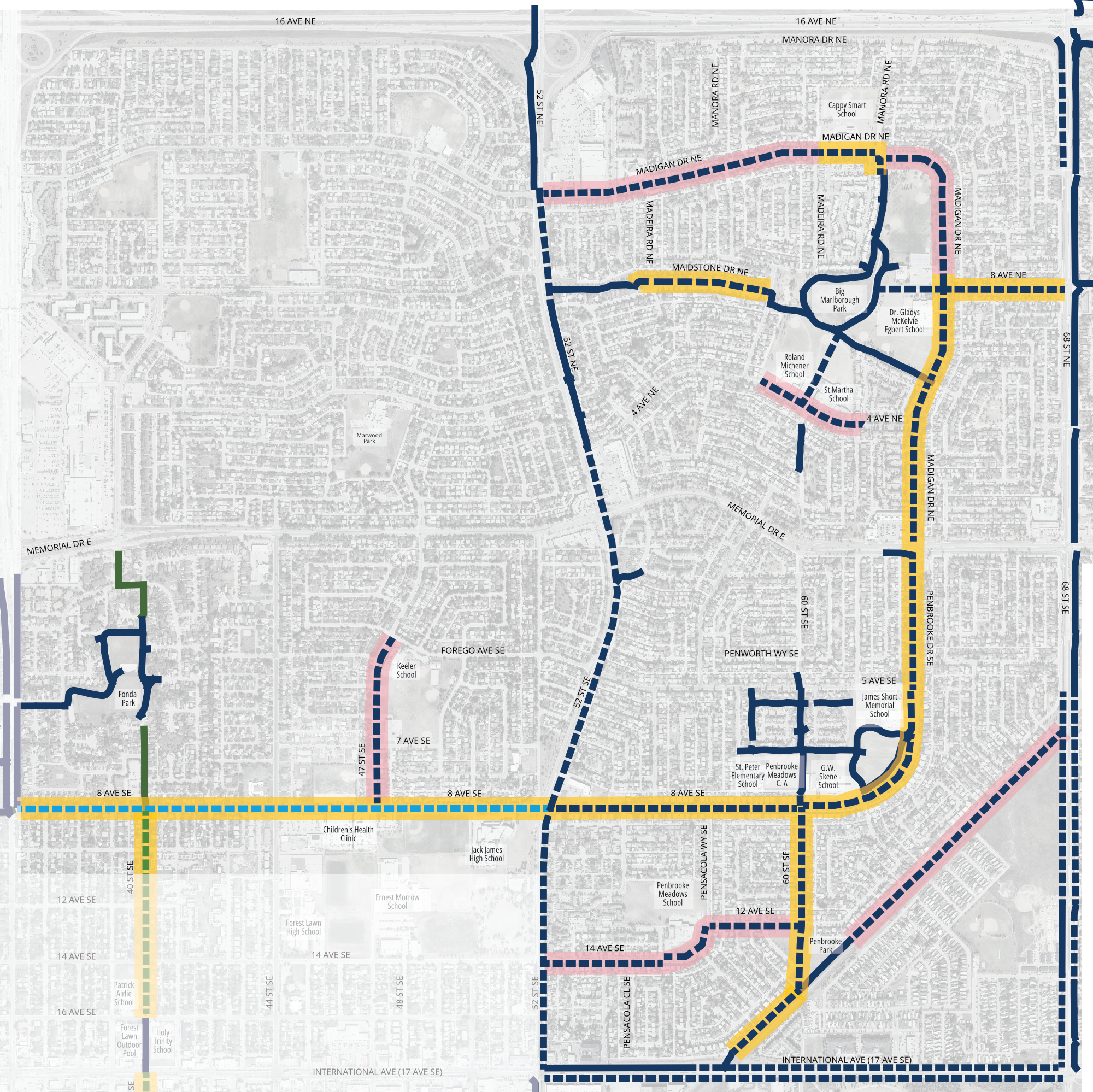
We will finish the designs for the yellow Priority 1 pathway sections shown below first.
What we are showing you now is our early concept designs.
The project team will be looking for further funding in the 2027–2030 budget to continue the work and create more detailed designs and money to build these pathways.
As we get closer to building the pathways, we will keep talking with nearby residents and property owners to share updates and answer questions.
Video describing what we are doing
Video time stamps by neighbourhood:
- Introduction
- Marlborough Park 5:48
- Penbrooke Meadows 10:04
- Forest Lawn/ Forest Heights/ Albert Park Radisson Heights 13:17
- Forest Lawn, Dover, Southview 19:16
- Erin Woods 20:05
Phase: 3 Reveal - What we are going to build
The interactive map below shows the routes and options we selected using this legend:
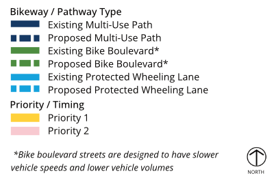
North Map
Interactive map: Click each colored dot to view details and proposed images.
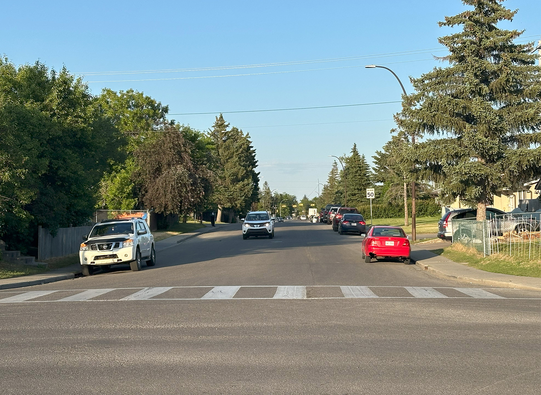
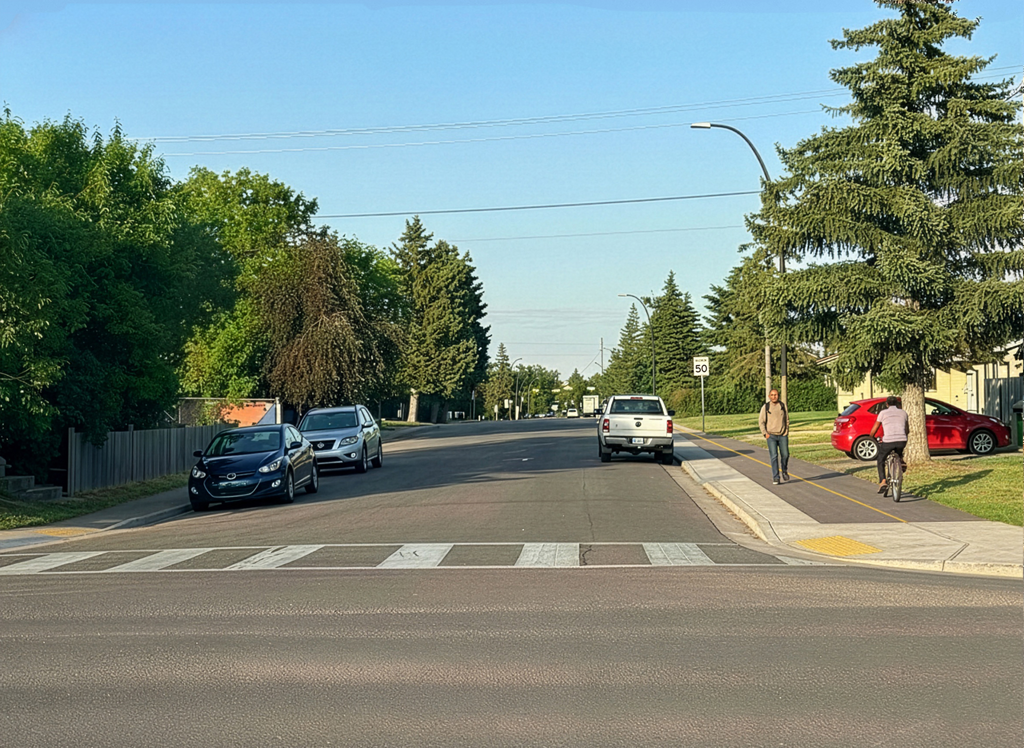
Before and After Images
We picked three streets so you can see what they look like before and after the proposed changes.
Click the tabs to switch between 8 Ave NE, Penbrooke Dr SE, and 60 St SE.
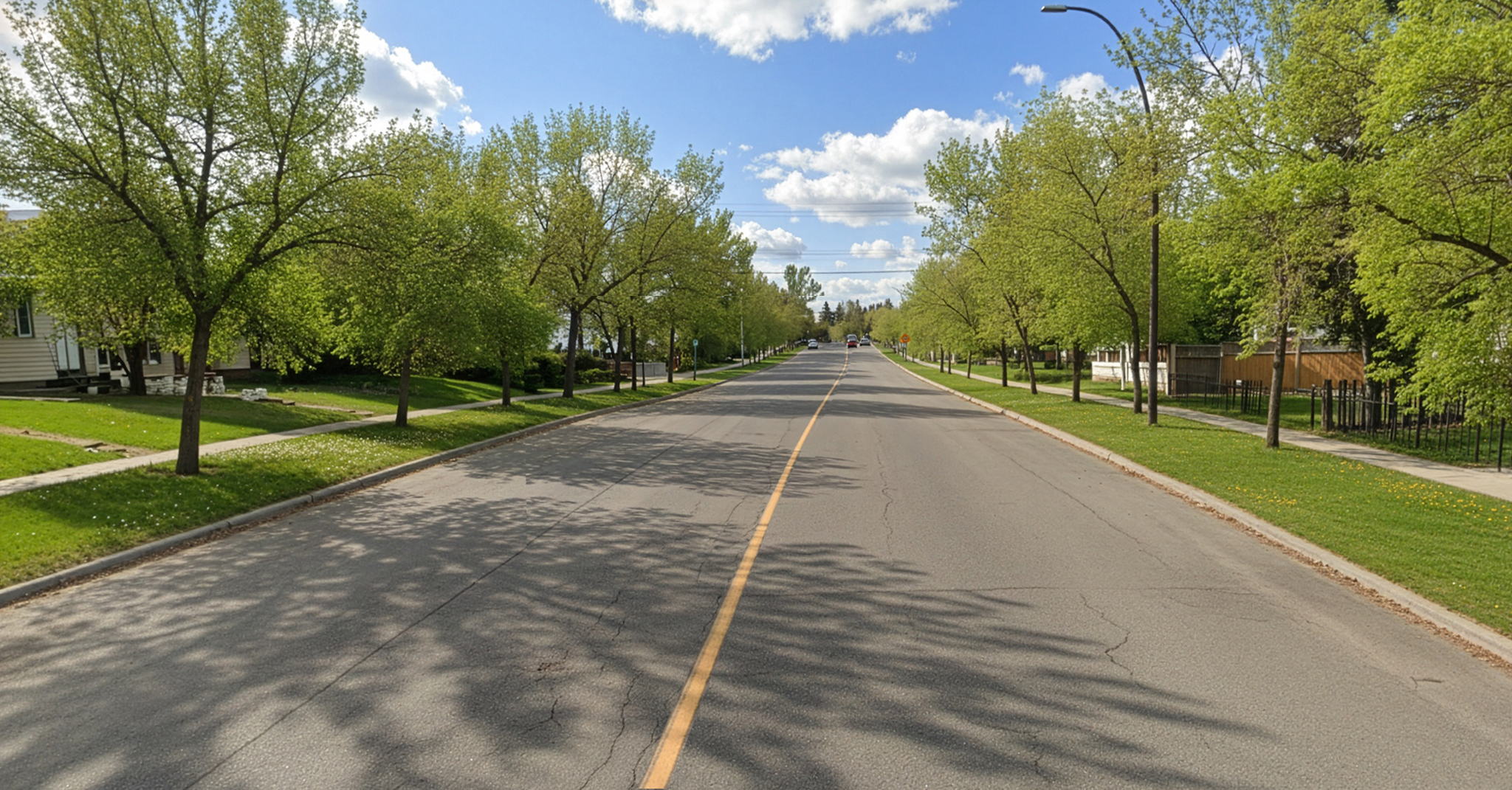
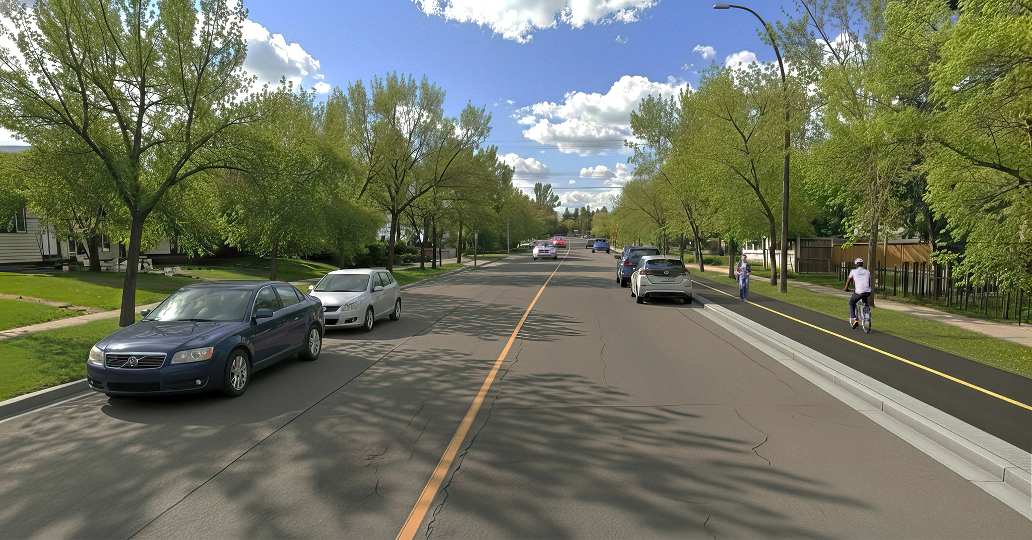
8 Ave NE
- This photo is taken standing on Madigan Drive looking east.
- The left side of the photo is north and the right side with the pathway is the south side.
- Move the slider on each picture to compare the two views.
These images are examples only and may not show the exact final design.
Penbrooke Dr SE
- This photo is taken looking south on Penbrooke Drive. The left side is east, and the right side is west.
- Move the slider on each picture to compare the two views.
These images are examples only and may not show the exact final design.
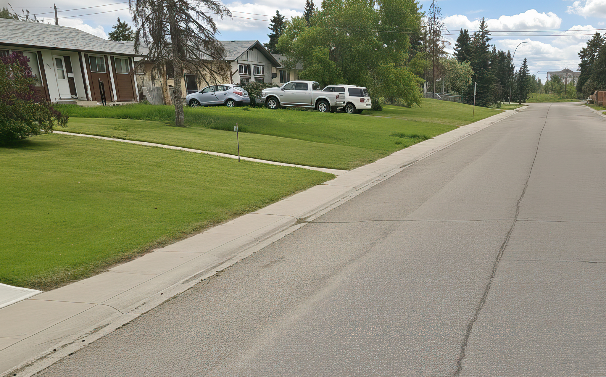
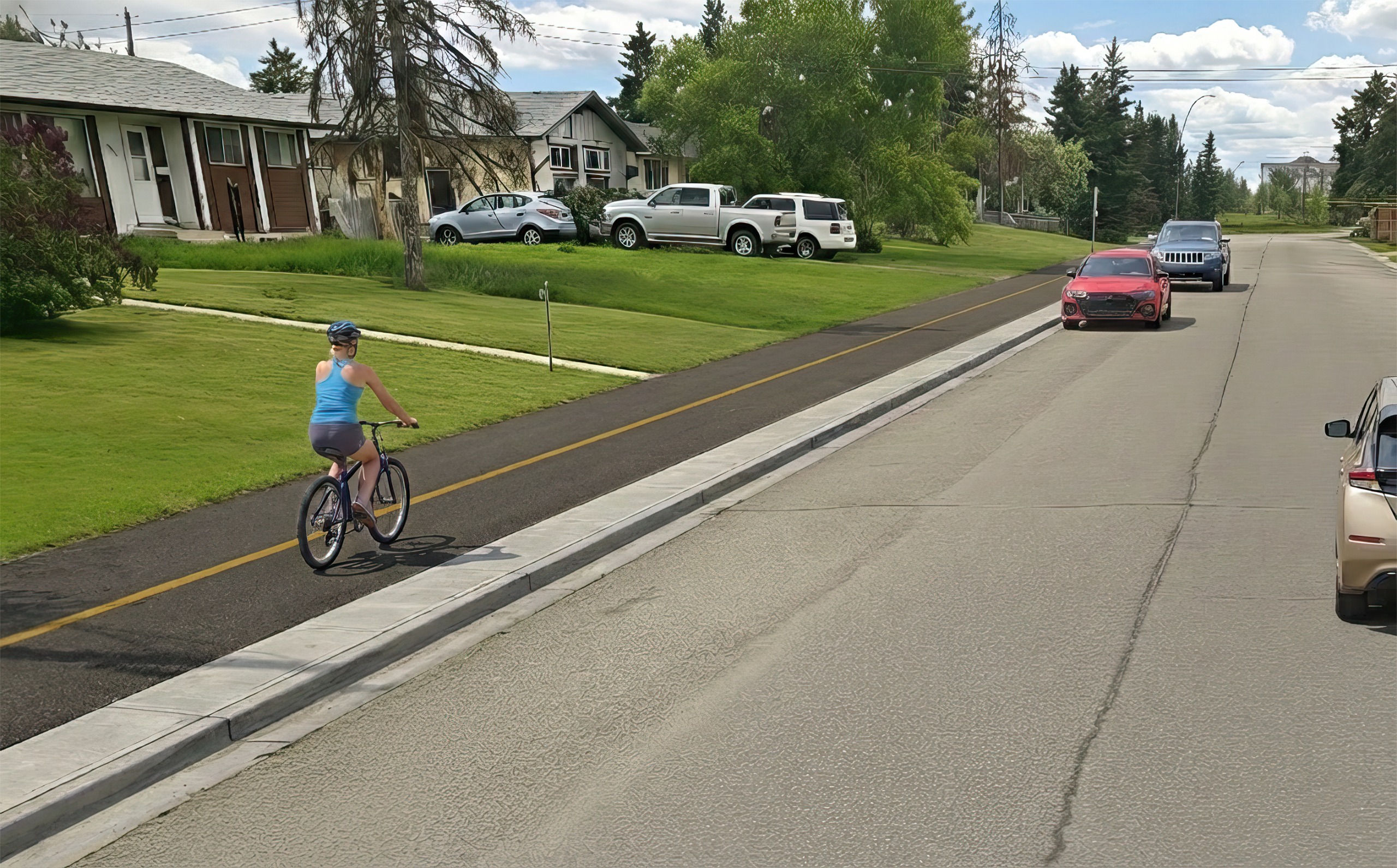
60 St SE
- This photo is taken facing south looking towards Penbrooke Park. The left side with the pathway is east side and the right side is west.
- Move the slider on each picture to compare the two views.
These images are examples only and may not show the exact final design.
South Map
Interactive map: Click each colored dot to view details and proposed images
Survey!
The survey was open until Feb 16, 2026. Check back soon for the What We Heard Report.
Past Engagement Phase 2
Thank you for your feedback! Engagement for Phase 2 was open June 7 to July 14, 2025, and is now closed. You can view the Phase 2 What We Heard Report in the reports section for more information. If you want to see what was asked or the maps for Phase 2 click on the drop down tabs below to view.
Albert Park Radisson Heights, Marlborough Park, Penbrooke Meadows, Forest Heights and Forest Lawn
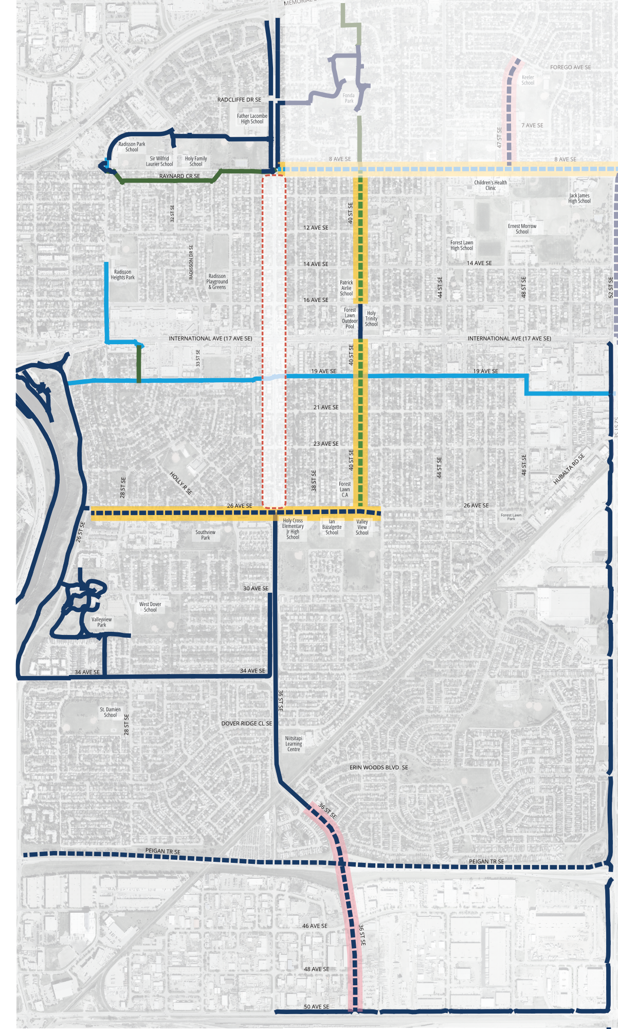
This map below shows the safety measures, pathways and bikeways we are proposing in Marlborough Park, Penbrooke Meadows, Forest Heights and Forest Lawn to safely connect people walking, biking and wheeling to home, school, parks, stores and services. *This is likely easier to view on a desktop than mobile phone. To comment on 36 St and 40 St SE south of 8 Ave and north of 26 Ave SE click the other tab above.
Click on each colored dot to see what we are proposing in each area.
- Yellow dots show where there are impacts in front of houses. If you have comments on these designs, you can share them in the open question at the bottom.
- Red or purple dots have options, and we need your help on the surveys for each one below the map.
- There is additional space for you to share general thoughts in the last question box.
After exploring the map, scroll down for surveys. For the southeast map: Radisson Heights, Dover, Erin Woods and Southview click the tab beside this one.


Albert Park Radisson Heights, Forest Lawn, Southview, Dover, and Erin Woods
This map below shows the safety measures, pathways and bikeways we are proposing in Forest Lawn, Forest Heights, Southview, Dover, and Erin Woods to safely connect people walking, biking and wheeling to home, school, parks, stores and services. *This is likely easier to view on a desktop than mobile phone.
Click on each colored dot to see what we are proposing in each area.
- Yellow dots show where there are impacts in front of houses. If you have comments on these designs, you can share them in the open question at the bottom.
- Red or purple dots have options, and we need your help on the surveys for each one below the map.
- There is additional space for you to share general thoughts in the last question box
After exploring the map, scroll down for surveys.


