ABOUT THE PROJECT

Calgary’s river valleys are essential to our city—they’re at the core of our city’s identity and its appeal as a place to live, work and play. 

Making careful decisions about how we plan, protect, develop and build in the floodplain is key to Calgary’s flood resilience. The Government of Alberta has released draft updated Flood Hazard Area maps for communities across the province, including Calgary. These maps reflect the latest understanding of a 1:100 (1 per cent chance) flood risk in Alberta and include a new approach to flood hazard area mapping. This mapping will be used to update Calgary’s relevant land use regulations, following public engagement.

The City is planning for the future of our river valleys, including our flood hazard areas, through the Calgary River Valleys Project. Stage 2 engagement is now completed. During this engagement, we looked at floodplain policy and land use decisions, with a focus on location-specific regulations and flood mapping. A what we heard report will be coming out soon.

The project will create and consolidate:

  • Principles for public space planning to provide direction that guides future recreation, trails, environmental protection, and land management decisions.
  • Principles for private land planning that provide direction on land use tools like reserves, setbacks, design requirements, densities and other land use tools that shape development.
  • Inform amendments to the Municipal Development (Calgary) Plan and Land Use (Zoning) Bylaw, ensuring that Calgary’s guiding documents consistently address development, planning and investment in our river valleys and areas impacted by flooding.

The decisions we make today about the river valleys will have long-term impacts, so it is important to articulate smart, long-term priorities for land use, conservation, planning and investment.

Bold actions now will determine future climate change and flood resilience, and the well-being of Calgary’s environment, communities and citizens.

We know Calgarians value our river valleys. That’s why your input on how we make decisions on the use, conservation and development of our river valleys and communities is important.

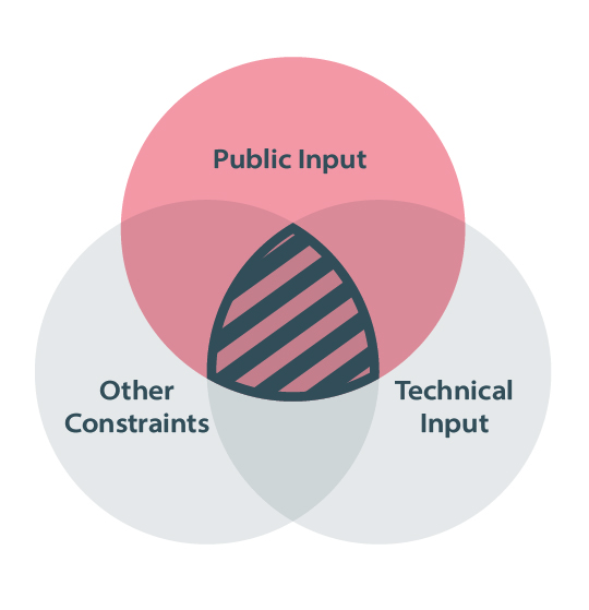
What we learn from public engagement, along with Indigenous knowledge, expert and technical advice will inform the development of new river valley policies and regulations. These will help to shape our community for years to come.


PROJECT ENGAGEMENT AND SURVEYS

INTRODUCTION

This engagement is split into three sections:

  • City Wide – (~2-5 minutes) - answer four broad questions about planning decisions in flood hazard areas.
  • Flood Hazard Area Zones - (~5-20 minutes) learn more about the new Flood Hazard Area Zones in Calgary, where they apply, and provide feedback about new regulations we are considering.
  • Land Use Planning - (~20 – 40 minutes) - explore how development can be shaped to reduce risk and provide feedback on proposed regulation for topics including density, land use, building and site design.

We suggest starting by learning about your reach of the river, and what changes may be taking place in your community:

If you are interested in providing feedback on the new draft flood maps produced by the Government of Alberta, please visit https://www.alberta.ca/bow-elbow-river-flood-study-engagement by February 12, 2024.

CITY WIDE QUESTIONS

FLOOD HAZARD AREA ZONES

These zones are the basis for our land use and development regulations.

Click on the cards to below to learn more about the new Flood Hazard Area Zones in Calgary, where they apply, and provide feedback about new regulations we are considering.

Each of the surveys will take approximately 10 minutes to complete and are optional.

LAND USE PLANNING

Click on the cards to below to to explore how development can be shaped to reduce risk while still supporting the river communities we love and provide feedback.

Each of the surveys will take approximately 15 minutes to complete and are optional.


ADDITIONAL BACKGROUND INFORMATION

The Government of Alberta manages the production of Flood Hazard Area maps, which identify the areas of land that would be impacted by river flooding during a 1:100 design flood. This means a flood that has a one per cent chance of occurring each year. The flood hazard areas are divided into different zones based on the level of intensity of the flood water.

The maps reflect the existing flood mitigation infrastructure in place at the time of the studies. Going forward, revisions to the Flood Hazard Area maps will be considered when flood mitigation, like the Springbank Off-stream Reservoir on the Elbow River and flood barriers, are constructed or upgraded.  

Flooding can cause damage to property, hardship to people and loss of life. Cities use Flood Hazard Area maps to guide local decision-making that will help keep people safe and protect their properties from floods.

The draft updated Flood Hazard Area maps reflect the latest understanding of a 1:100 flood risk across the province, including Calgary. The province has adopted a new approach for flood hazard area mapping. This approach divides the flood hazard area into four categories (two of which are new) that reflect the level of risk: 

  • Floodway: An areawhere flows are deepest, fastest and most destructive. New development is typically discouraged in this zone.
  • High Hazard Flood Fringe (New): An area outside of the floodway, where the flow during a 1:100 flood would be deeper (greater than 1 metre) and/or faster (greater than 1 metre/second) than the rest of the flood fringe.
  • Flood Fringe: An area where the flow during a 1:100 flood would be shallower, slower and less destructive than the High Hazard Flood Fringe. This is an existing classification, but the boundaries may have changed.
  • Protected Flood Fringe (New): An area where dedicated existing flood mitigation infrastructure (such as City-owned and maintained flood barriers) protects the area to at least the 1:100 flood level. 

The existing Overland Flow Zone designation is being removed, as these areas are being incorporated into the other zones as appropriate.

Visit www.alberta.ca/bow-elbow-river-flood-study-engagem... for more information on draft flood maps for Calagry, including additional resources on flood studies and frequently asked questions.

Many of Calgary’s older communities were built on rivers’ floodplains. Over the decades, our understanding of the flood risk in these areas has improved, leading to safer building practices. Since the 2013 flood, changes have been made to the Municipal Development Plan and Land Use Bylaw to provide guidance and better regulate development within the Flood Hazard Area.

Today, some property-level flood-proofing is required through building regulations during renovations and new builds. Measures may include:

  • Building the main floor above the flood level
  • Installing sump pumps and backflow valves
  • Elevating furnaces and electrical panels

Other voluntary actions can further reduce damages to homes, such as installing water alarms in the basement and finishing the basement with easy-to-clean materials. 

As part of the Calgary River Valleys Project, floodplain policies and regulations are being reviewed and will be incorporated in the Municipal Development (Calgary) Plan and Land Use (Zoning). 

Flood hazard areas are not shown on the draft updated map for the Elbow River, downstream of the Glenmore Dam. Flows are currently being re-assessed to include the effect of the Springbank Off-stream Reservoir (SR1), which will be operational in 2025. The flood mitigation provided by SR1 will have a significant impact on 1:100 flood flows along the Elbow River. It will also reduce flood flows in Calgary on the Bow River downstream of the confluence with the Elbow River, but there will be less impact on the Bow than on the Elbow. The potential impacts of SR1 on a wide range of flood flows are being currently assessed and will be reflected in flood maps when the reservoir is operational. We can estimate, however, that with SR1, a 1:100 flood will look more like the current 1:5 flood map.

There will still be risks that exist in the Elbow River Valley with SR1 in place. As such, some regulation will still be required to ensure these risks are adequately addressed in development planning and building design. Potential risks include: 

  • Risk of a larger flood than both the SR1 and the Glenmore Reservoir can handle
  • Risk of increasing flood flows due to our changing climate
  • Risk of high groundwater in the river valley due to high river levels during and after flood events

The Elbow River is one area within Calgary’s Flood Hazard Area map, which is part of the larger mapping study that covers the whole province, all of which were released in December, 2023. 

Calgary’s new Flood Hazard Area map reflects current flood risk and is based on the 1:100 inundation map published by AEPA in 2020. Because the new Flood Hazard Area map reflects updated risk, including completed flood barriers, some areas on the map will now be shown as “protected.” Not releasing the Flood Hazard Area map for Calgary until SR1 is complete would mean delaying the public release of the latest understanding of how a 1:100 flood would impact all areas of Calgary, not just along the Elbow River.

The goal of the Government of Alberta is for the post-SR1 flood map to be ready as soon as SR1 is operational. Of course, this is dependent on having determined operating procedures and new mitigated flows, and various factors could potentially delay completion of the maps. 

Regulation in the flood zones is the jurisdiction of The City of Calgary. Until the new Flood Hazard Area maps are finalized and City of Calgary policies and bylaws have been updated, development applications will continue to be assessed according to existing regulations. The City also considers information from the draft updated Flood Hazard Area map to provide advisory comments for further resilience. As always, applicants may draw on additional information in support of their applications. 

Both The City of Calgary and the Government of Alberta recognize the importance of having timely maps that reflect current, actual risk. Structural mitigation under construction or in planning phases are not yet reflected in new maps, such as the Sunnyside Barrier. Once projects are completed, the province has a process for reassessing the impacts on calculated flood levels and flood maps and will consider impacts to the flood map. In some cases, including for the Sunnyside Barrier, post project scenarios have been modeled and are addressed in the accompanying report.

Insurers produce and use their own flood maps and have indicated they do not typically use government flood maps.  Both The Government of Alberta and The City of Calgary are happy to speak to property owners about how their property is mapped and can provide information for insurers upon request. Calgarians can contact 311 to inquire about the status of mapping, applicable bylaw regulations, advisory information or development implications on their property.

No. Provincial flood studies focus on river flood hazards – the situation when high water escapes the river and inundates the floodplain. However, many riverside communities in Calgary may experience basement flooding when heavy rain or higher river levels cause changes in the groundwater table. As part of the Calgary River Valleys Project public engagement on floodplain policies and regulations, we’ll use our technical understanding of river conditions to explore the potential for property-level regulations to better manage this risk.

Many of Calgary’s older communities were built on rivers’ floodplains. Over the decades, our understanding of the flood risk in these areas has improved, leading to safer building practices.

There are a number of actions that have advanced The City’s land use and flood resilience context, including the 2014 updates to flood hazard area regulations in the Land Use Bylaw (LUB) and updates the Municipal Development Plan (MDP). 

As part of the Calgary River Valleys Project, floodplain policies and regulations are being reviewed and modernized to protect and enhance our river valleys while helping shape more resilient river communities and guide updates to the Land Use (Zoning) Bylaw and the Calgary Plan. 

Climate change is shifting precipitation patterns, increasing rainfall intensity and causing an earlier melting of the mountain snowpack. As a result, river flood hazards are increasing for the Bow and Elbow River watersheds. Updating our land use planning policy and regulations is a key action in Calgary’s Flood Resilience Plan as well as our Calgary Climate Strategy.

As part of the Calgary River Valleys Project public engagement on floodplain policies and regulations, we are exploring how climate change risk projections will be incorporated into today’s floodplain planning and development decisions and regulations. 

We are committed to engaging with Calgarians and all interested parties prior to making any policy and regulatory revisions.

The following policy and regulatory directions have been raised for consideration and will frame key discussions in Calgary River Valleys Project – Stage 2 engagement:

  • How to align planning and development decisions with investments in flood protection.
  • How to ensure Calgary’s buildings are equipped to bounce back from increasingly severe floods as our climate changes. 
  • How to account for different types of flood risk, including both overland and groundwater flooding.

The City of Calgary has a responsibility to protect public safety and ensure that our affordable housing options are not vulnerable to hazards such as flooding.  

Generally, floodplain planning aims to reduce the number of people living in flood impacted areas, especially areas where a higher risk of flooding remains. Basements (including living areas or secondary suites) are vulnerable to flooding because underground spaces can quickly fill with water, risking life or personal safety and property damage. During river flood events, basements can be flooded by overland floodwater, or high groundwater that enters the basement through cracks and drains.  The changes being contemplated for below-ground living spaces only apply to a few areas in our communities, leaving many other areas that are safer and available for increasing housing choice. It is important that The City of Calgary balances all these priorities, and continues to reduce flood risk while supporting safe, resilient, vibrant and affordable communities.

As our city continues to grow and the information available about flood risk evolves, it is important that we continue to revisit our land use policies and building regulations in flood hazard areas to guide how we plan and develop in river communities to make them more resilient.

Key outcomes of the Calgary River Valleys Project include adding river valley and flood hazard policy content in the Calgary Plan and updating Flood Hazard Area regulations in the updated Land Use (Zoning) Bylaw.

The City is launching several important public engagements in January 2024 to support the following projects: 

  • Calgary River Valley Project - Stage 2 public engagement: January 29 – March 3, 2024
  • City Building Program Phase 2 public engagement: January 29 – March 3, 2024
  • Rezoning for Housing (R-CG): Beginning January 15th, 2024

The City is collaborating across these programs to help Calgarians understand how they can participate in each engagement. Additional resources can be accessed about each project at the following links:

www.calgary.ca/rivervalleys or www.alberta.ca/bow-elbow-river-flood-study-engagem...

www.calgary.ca/citybuilding

www.calgary.ca/rezoningforhousing


PHASE 1 ENGAGEMENT ARCHIVE


SUMMARY

PROVIDE YOUR INPUT

Stage 1 engagement focused on our river valleys – we were gauging what Calgarian's value about the recreation, design, environment and flood resilience of the river valleys and exploring what uses and experiences are appropriate in different locations in the river valley and how to resolve tensions.

These values will inform future stages of engagement, which will focus more on floodplain development and regulation.

NEXT STEPS

The What We Heard report for Stage 1 engagement is now available.

Stay tuned – More information about future engagement stages for the Calgary River Valleys Project will be announced here when available.


When you think of Calgary’s river valleys, what comes to mind?

The river valley is an important part of Calgary’s identity as a city. Share a place, memory, or feeling you have about our river and the surrounding areas.


SURVEY: VALUES

PUBLIC SURVEY

Only have a little bit of time to share your thoughts? Complete this page of questions to ‘dip your toe’ in the engagement with minimal time required. This survey has two parts, allowing you to choose how to participate based on the amount of time you have and level of detail you are interested in.

Part 1: River Valley Values is a pulse check on what Calgarian’s value about the recreation, design, environment and flood resilience of the river valley.
Time required: Approx. 5 minutes

Survey closes June 5, 2023. Thank you for your participation!

SURVEY: PRIORITIES

The next set of questions will take more time to complete but allow you to dive into the content further. Feel free to skip to the end if you can’t spend the time or are not interested. This survey has two parts, allowing you to choose how to participate based on the amount of time you have and level of detail you are interested in.

Part 2: River Valley Priorities explores what uses and experiences are appropriate in different locations in the river valley and how to resolve tensions.
Time required: Approx. 10 minutes

Survey closes June 5, 2023. Thank you for your participation!

EVENTS

Key dates

Tuesday, July 18, 2023 11:00 am to 03:00 pm

Pop up Stage 1

This pop up will be by the Simmons Building in East Village to talk about values and priorities of the River Valley.

Wednesday, July 19, 2023 11:00 am to 02:00 pm

Pop up Stage 1

This pop up will be in Lindsay Park on the pathway behind the MNP Centre to talk about values and priorities of the River Valley.

Thursday, July 20, 2023 11:00 am to 02:00 pm

Pop up Stage 1

This pop up will be on the north side of Edworthy Park near Angel's Cafe to talk about values and priorities of the River Valley.

Thursday, April 27, 2023 04:00 pm to 08:00 pm

In-person feedback: Stage 1 River Valley Roadshow

Location: Old Fire Hall # 6 (Poppy Plaza)

Description: Drop in anytime between 4 – 8 p.m. to learn more about Calgary’s river valleys. This is an opportunity for you to share what you value about our river valleys and your vision for their future.

Impacted Communities: This drop in event is open to everyone in The City.

Impacted Wards: All

Thursday, May 04, 2023 04:00 pm to 08:00 pm

In-person feedback: Stage 1 River Valley Roadshow

Location: Seton Public Library

Description: Drop in anytime between 4 – 8 p.m. to learn more about Calgary’s river valleys. This is an opportunity for you to share what you value about our river valleys and your vision for their future.

Impacted Communities: This drop in event is open to everyone in The City.

Impacted Wards: All

Wednesday, May 10, 2023 04:00 pm to 08:00 pm

In-person feedback: Stage 1 River Valley Roadshow + Panel Discussion

Location: Fort Calgary

Description: Drop in anytime between 4 – 8 p.m. to learn more about Calgary’s river valleys. This is an opportunity for you to share what you value about our river valleys and your vision for their future. Join us at 6:30 p.m. for an informative and inspiring talk about our river valleys. More details on this RiverTalk topic and our guest speakers will be available soon.

Impacted Communities: This drop in event is open to everyone in The City.

Impacted Wards: All

Tuesday, May 16, 2023 04:00 pm to 08:00 pm

In-person feedback: Stage 1 River Valley Roadshow

Location: Four Points by Sheraton Calgary West

8220 Bowridge Crescent NW

Description: Drop in anytime between 4 – 8 p.m. to learn more about Calgary’s river valleys. This is an opportunity for you to share what you value about our river valleys and your vision for their future.

Impacted Communities: This drop in event is open to everyone in The City.

Impacted Wards: All

Thursday, April 27, 2023 to Monday, June 05, 2023

Online feedback: Stage 1

Description: Share your vision for the future of Calgary’s river valleys online from April 27 – June 5.

Impacted Communities: All

Impacted Wards: All

ADDITIONAL INFORMATION

A river valley is simply an elongated feature on the Earth’s surface carved by a river. Each river valley includes a valley floor and valley sides.

The Bow River Valley is the dominant landform throughout Calgary. It shapes much of the topography and character of Calgary as a whole, truly making our city “a great place to make a living – a great place to make a life.”

The Elbow River Valley is the second biggest river valley landform in Calgary, followed by the Nose, West Nose and Fish Creek Valleys.

In Calgary, our river valleys are home to many communities, our downtown core, and our parks and pathway networks. Our river valleys are critical ecological corridors, encompassing natural open spaces, trees, terrestrial wildlife habitats and riparian areas. River valleys feature in Calgary’s origin story and are woven into our place names. The confluence of the rivers is known as Moh’kinsstis by the Blackfoot people, Wicispa Oyade by the Stoney Nakoda people, Guts’ists’i by the Tsuut’ina and Otoskwunee by the Métis. River valleys are also a key part of Calgary’s visual landscape and wayfinding system.

Developed in 1983, the Calgary River Valleys Plan contains a range of policies on development, recreational use and conservation of Calgary’s rivers, creeks and adjacent lands.

There have been significant changes to our river valleys in the last 40 years, including development of a parks and open space system, our experience with the 2013 flood, continued growth pressure and land use decisions in our city and a changing climate.

Updating river valley policies and regulations through the Calgary River Valleys Project will ensure we continue to anchor our river valleys in long-term city planning decisions and resiliency, guided by values of climate resilience, equity, reconciliation and economic development.

Given the broad purpose of the Calgary River Valleys Project, it is crucial we hear from everyone that has an interest in our river valley areas, including Indigenous communities, community members, civic partners and developers, to consider all perspectives as we explore coordinated and integrated policy options.

A multi-staged engagement approach is being conducted in 2023 and 2024.

  • Stage 1 (spring 2023) clarified priorities and values for our river valley communities
  • Stage 2 (anticipated late 2023) will look at floodplain policy and land use decisions, with a focus on location-specific regulations and flood mapping.
  • In future stages, we will share draft Calgary River Valleys policies and regulations for feedback.

River valleys are also sacred spaces, and all planning activities must be rooted in an understanding of settler-colonial relations, Treaty history and Indigenous rights. A critical focus throughout all stages of the project is Indigenous engagement that is rooted in respect, relationship building and ethical-space. As part of this, a series of gatherings to convene Elders, Knowledge Keepers and members of Treaty 7 Nations, Métis Nation of Alberta Region 3 and urban Indigenous Calgarians are taking place in 2023.

We know Calgarians value our river valleys. That’s why your input on how we make decisions on the use, conservation and development of our river valleys and communities is important.

What we learn from public engagement, along with Indigenous knowledge, expert and technical advice will inform the development of new river valley policies and regulations. These will help to shape our community for years to come.

Learn how you can get involved at Calgary.ca/RiverValleys.

Making careful decisions about land use planning and development regulations in the floodplain is a fundamental part of Calgary’s approach to building flood and climate resilience and supports our overall Flood Resilience Plan.

There are a number of actions that have advanced The City’s land use and flood resilience context, including the 2014 updates to flood hazard area regulations in the Land Use Bylaw (LUB), and updates to Section 4.4 of the Municipal Development Plan (MDP). As our city continues to grow, and the information available about flood risk evolves and improves, it is important that we continue to revisit floodplain land use policies and building regulations to guide how we plan and develop in river communities to make them more resilient.

As part of the Calgary River Valleys Project, floodplain policies and regulations will be reviewed and modernized to protect and enhance our river valleys, while helping shape more resilient river communities, and guiding updates to the LUB, the MDP, and related plans and regulations. This will be further explored in Stage 2 engagement (anticipated late 2023).

We are committed to engaging with Calgarians and all interested parties prior to making any policy and regulatory revisions. While a review of our river valley and floodplain-related policies will potentially lead to updates to the Municipal Development Plan, local area plans, Land Use Bylaw and other relevant planning documents and regulations, any decisions made will be informed by the results of our extensive public and Indigenous engagement, as well as expert and technical advice.

The Calgary River Valleys Project provides detailed direction and guidance for decisions about how we plan, develop and build within the whole river valleys system. Connect: Calgary’s Parks Plan provides high level direction for the protection and management of land adjacent to the river within parks. Information about that project and engagement can be found at engage.calgary.ca/parksplan.