Maps showing future pathways.
Scroll down to see the maps for all neighbourhoods that will be built after 2026 as funding becomes available. Click on the pathway that interests you to learn more. If you have any questions feel free to reach out to the project team at 5Award5connections@calgary.ca.
Martindale
This map below shows the safety measures, pathways and bikeways we are proposing in Martindale to safely connect people walking, biking and wheeling to home, school, parks, stores and services.
Click on each colored icon to see what we are proposing in each area. Blue, yellow and green dots show places where we propose the most balanced solution to minimize impacts such as parking or tree loss. Use the legend and the images to see what type of pathway it will be.
For the areas outlined in red (red dots) see the Phase 3 Map for the option selected here.

Map Legend


Taradale/ Saddle Ridge
This map below shows the safety measures, pathways and bikeways we are proposing in Taradale/ Saddle Ridge to safely connect people walking, biking and wheeling to home, school, parks, stores and services.
Click on each colored icon to see what we are proposing in each area. Blue, yellow and green dots show places where we propose the most balanced solution to minimize impacts such as parking or tree loss. Use the legend and the images to see what type of pathway it will be.
For the areas outlined in red (red dots) see the Phase 3 Map for the option selected here.

Map Legend
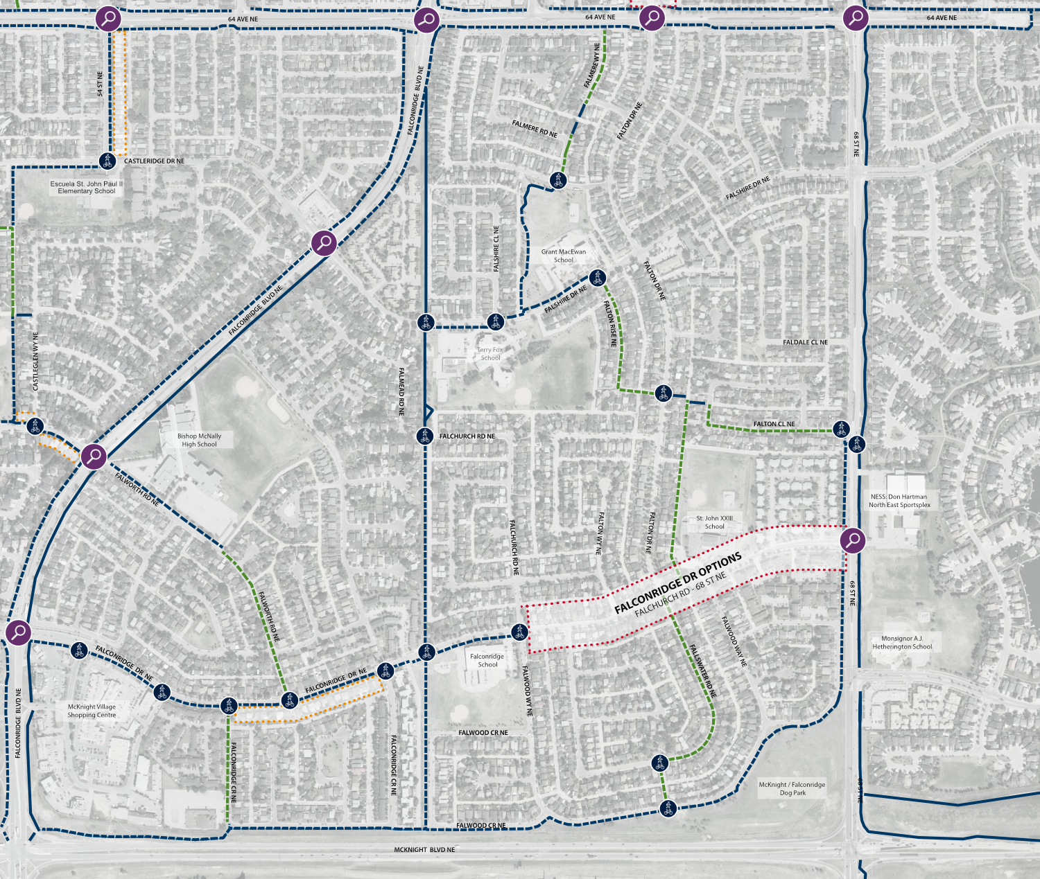
Falconridge
This map below shows the safety measures, pathways and bikeways we are proposing in Falconridge to safely connect people walking, biking and wheeling to home, school, parks, stores and services.
Click on each colored icon to see what we are proposing in each area. Blue, yellow and green dots show places where we propose the most balanced solution to minimize impacts such as parking or tree loss. Use the legend and the images to see what type of pathway it will be.
For the areas outlined in red (red dots) see the Phase 3 Map for the option selected here.
Map Legend
Castleridge
This map below shows the safety measures, pathways and bikeways we are proposing in Castleridge to safely connect people walking, biking and wheeling to home, school, parks, stores and services.
Click on each colored icon to see what we are proposing in each area. Blue, yellow and green dots show places where we propose the most balanced solution to minimize impacts such as parking or tree loss. Use the legend and the images to see what type of pathway it will be.
For the areas outlined in red (red dots) see the Phase 3 Map for the option selected here.

Map Legend


