Thank you for your feedback!
Public engagement is now closed. Stay tuned for next steps.
We have new designs to share!
We are excited to share new pathway and bikeway designs for the neighbourhoods of Falconridge, Taradale, Martindale, Saddle Ridge and Castleridge. We appreciate everyone who gave their input in Phase 1 and 2 of this project, as your valuable feedback has led to these final designs (See the Engagement Reports section at the bottom of this page for What We Heard/ What We Did Reports).
We designed new pathway and bikeway routes in Falconridge, Castleridge, Taradale, Saddle Ridge and Martindale, aligning with Calgary's established Pathway and Bikeway Network. These routes focus on connections that serve students, recreation, shopping, and work destinations. When built, these routes will provide safe, healthy, and affordable travel choices for people of all ages and all abilities.
This project was necessary for three main reasons:
- High number of schools and students in the area
Ward 5 has one of the highest concentrations of schools, and therefore students, in Calgary. Many students live close to their schools, which means safe walking and wheeling routes are very important.
- Safety data shows the need for improvement
Between 2017 and 2021, this area experienced a higher number of injury collisions compared to other parts of the city. Designing safer streets for students helps create safer routes for everyone.
- To better balance infrastructure investment across Calgary
Northeast Calgary has historically received less infrastructure investment than other areas. This project helps ensure City funding and infrastructure improvements are more evenly distributed across the city.
We used public input from Phase 1 and 2 along with other factors such as policies, best practices, budget and technical constraints to finalize the designs we now sharing with you. Some pathways will be constructed in 2026 and others in the years following as more funding becomes available. We will continue to talk with nearby property owners and community members as we move closer to construction to share details and answer questions. Read the What We Did Report here which explains why options were chosen.

Design concepts have been finalized and are being shared with the community in Winter 2025. We expect construction to begin in 2026 and will share construction updates as they become available.
You can watch the video or skip directly to the interactive map below it to explore at your own pace.
You can find information on the following communities at these timestamps:
- Project introduction
- 64 Ave 2:26
- Martindale 3:55
- Saddleridge/ Taradale 9:10
- Castleridge 13:45
- Falconridge 16:45
Video describing what we are doing
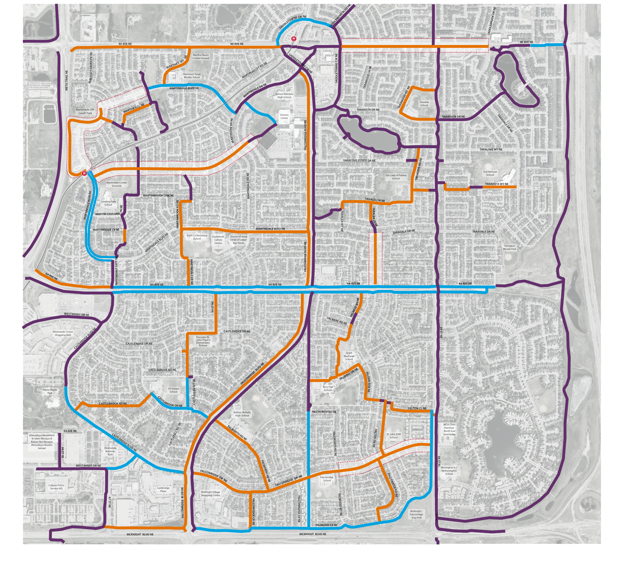
The map below shows the routes and options we selected using this legend:
You can click on each of the colored icons to show more details about what option we chose and why.
*If you click the magnifying glass the image will enlarge. Note: Images are a representative concept only.
Orange sections that don't have a flashing colored icon have more detail on this maps page. Click here to view those maps.
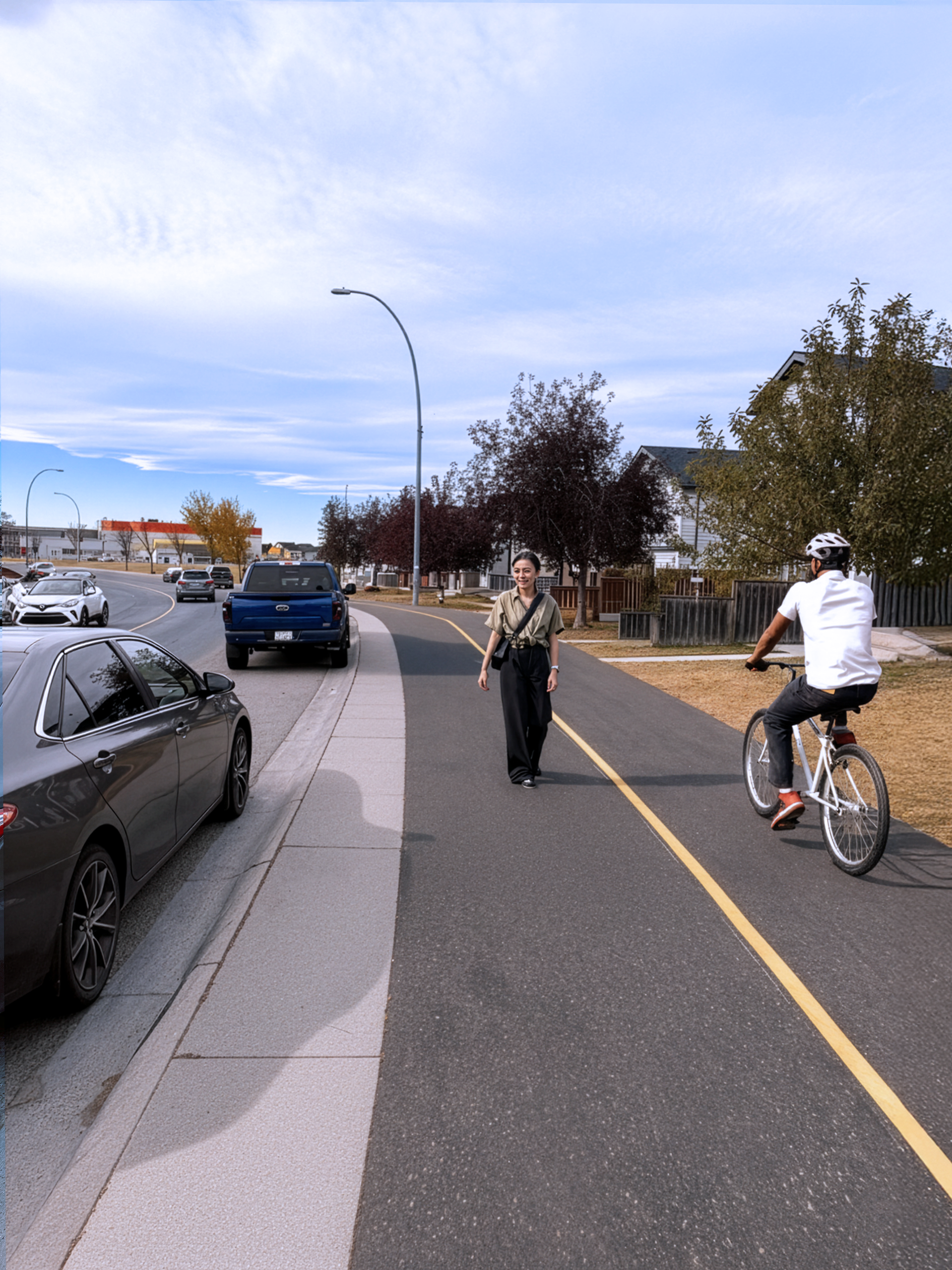
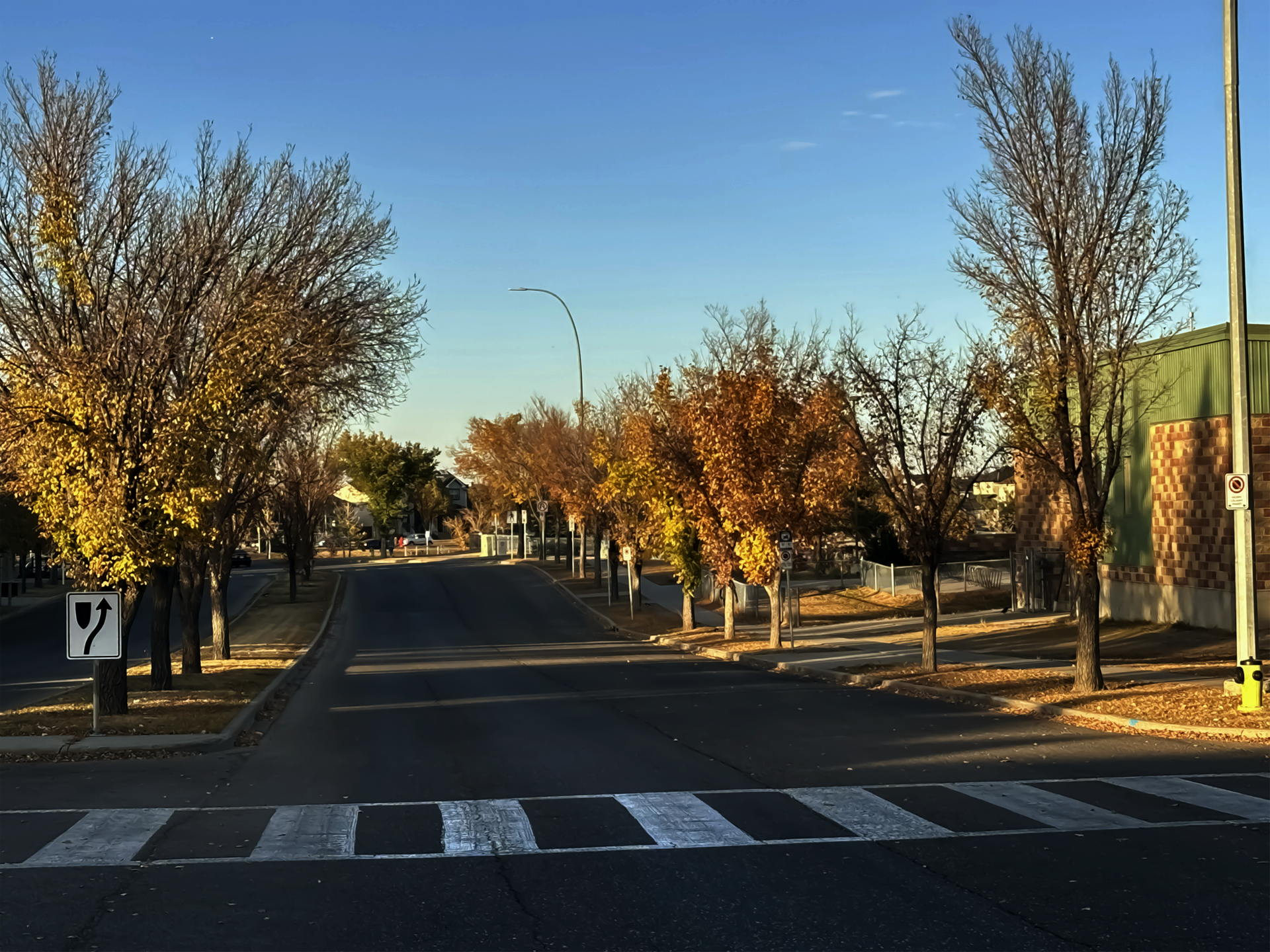
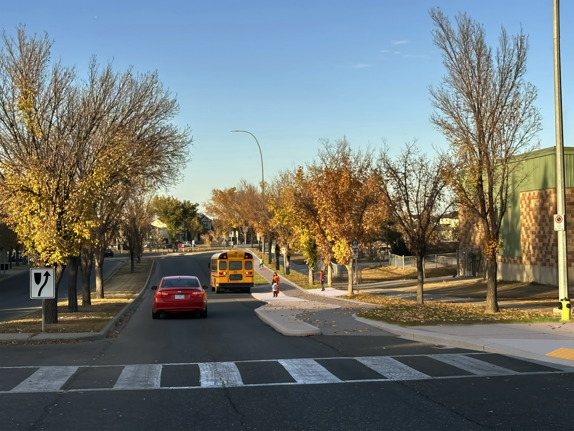
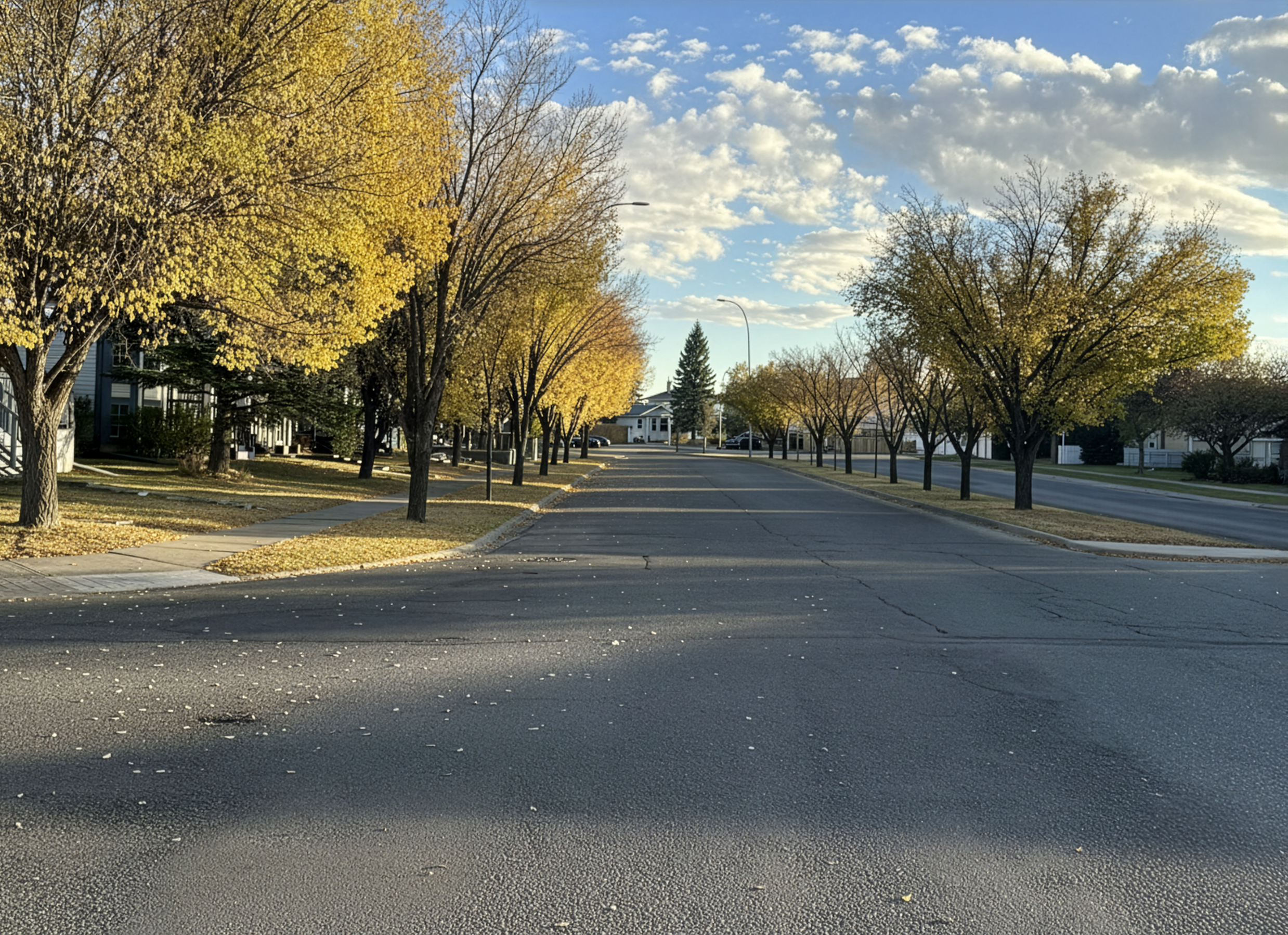
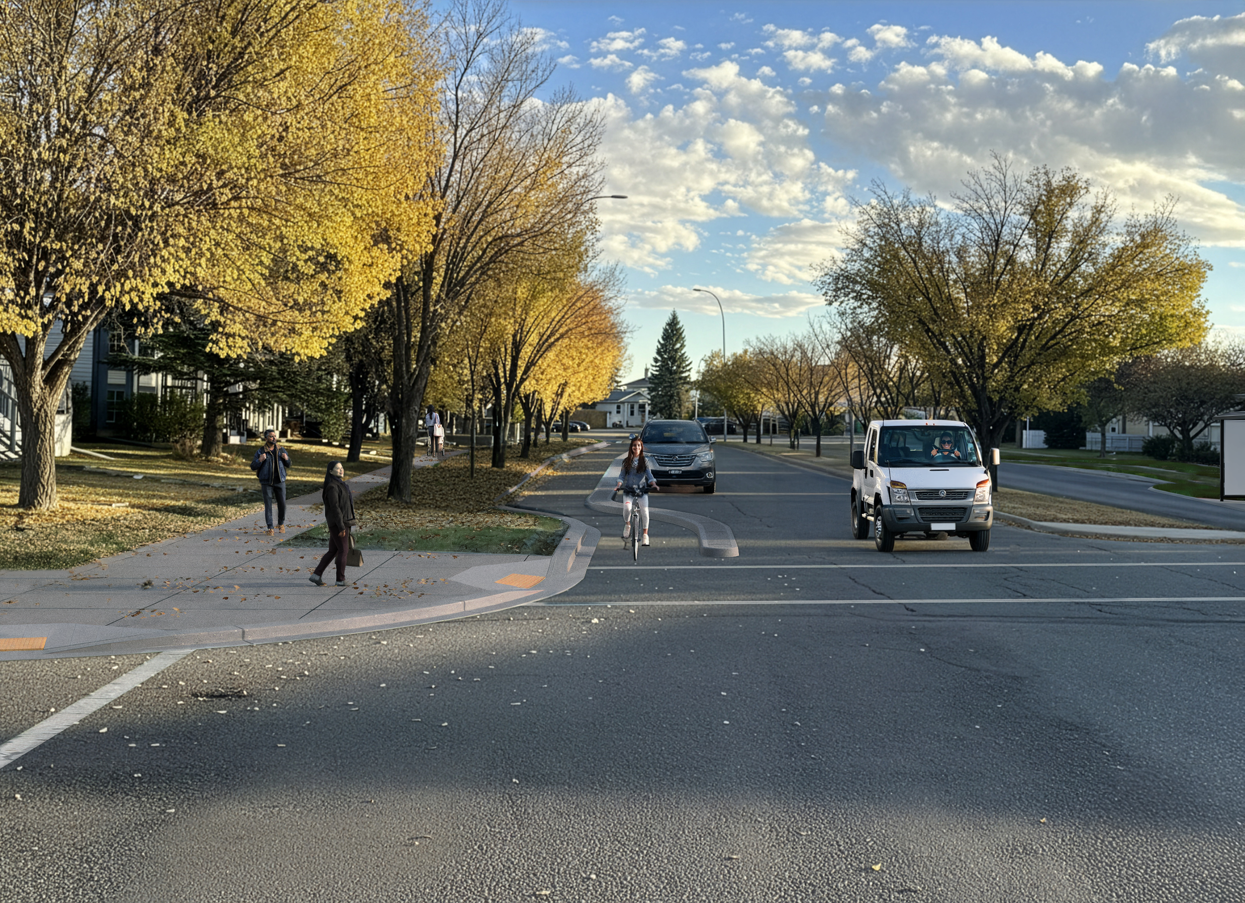
Before and After Images
Use the slider tool below to see the streets before and after the designs.
Click each tab (below the first image) to view the different locations. Note: Images are a representative concept only.
Castlebrook Drive

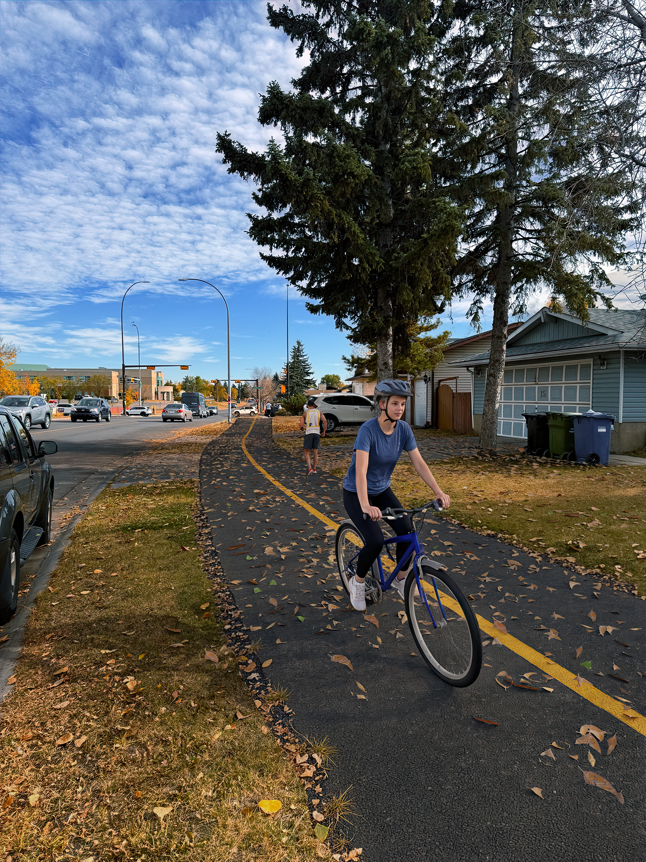
Martindale Blvd at Martin Crossing Park
Martindale Blvd at Martinridge Cres
Martindale Blvd at Martinvalley Rd