Cyclists and wheeling on the road
The design includes a multi-use path which will provide a space for people to bicycle, scooter, roller-skate, that is separate from motor vehicles. Cyclists are still legally permitted to cycle on the roadway.
Segment 1 of 14 Avenue N.W. spans a distance of approximately 680 metres from 24 Street N.W. to east of 20A Street N.W. within the residential neighbourhood of Hounsfield Heights - Briar Hill. Segment 1 features connection points to the current Crowchild Trail Pedestrian Overpass, transit stops, and connections to neighbourhood amenities including Briar Hill Elementary School and Hounsfield Heights Park. The Crowchild Trail Pedestrian Overpass has been proposed at 12 Avenue N.W. with a ramp running north to connect to 13 Avenue N.W. at grade, with proposed on-street bikeways connecting the ramp to both 14 Avenue N.W. and 12 Avenue N.W. The proposed upgrades consider existing and future connections to the Crowchild Trail Pedestrian Overpass and larger regional networks.
Click on the flashing hotspots below to see a description of the improvements/changes coming to that location or view the improvements shown on this map as a list.

Please note that these illustrated drawings are intended for visual and conceptual purposes only and are subject to change based on technical requirements.
The design includes a multi-use path which will provide a space for people to bicycle, scooter, roller-skate, that is separate from motor vehicles. Cyclists are still legally permitted to cycle on the roadway.
A parking study along 14 Ave N.W. showed peak demand was below 25%, indicating more supply than demand.
Parking is retained on most of the north side to maximize availability. South side parking was removed to widen lanes and formalize lanes and add a multi-use pathway without affecting landscaping.
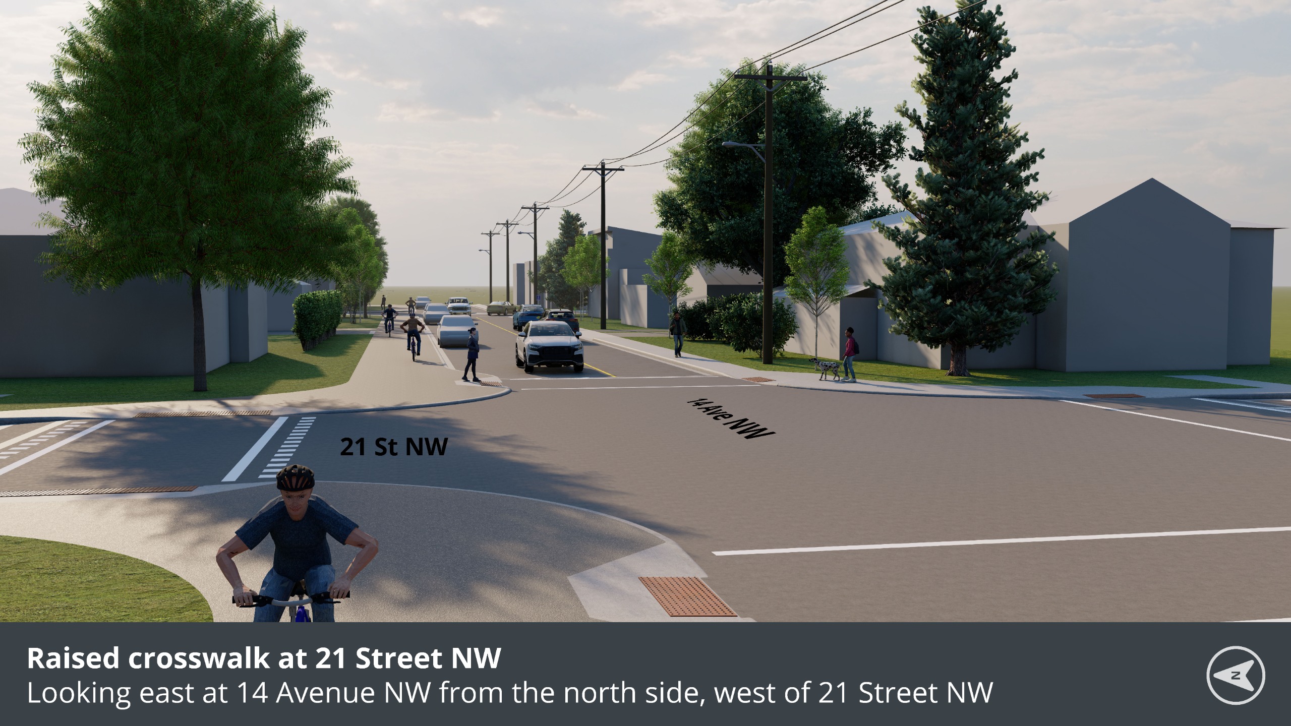
The design narrows the road width, creating a shorter distance for people crossing the road and reducing the time and length of exposure to motor vehicle traffic.
The design uses curb extensions to help drivers see people that are about to cross the road before they step onto the road.
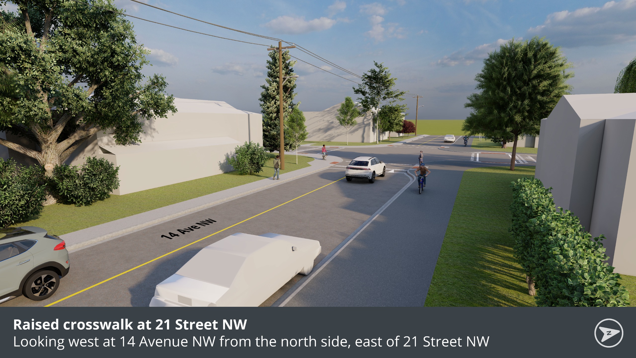
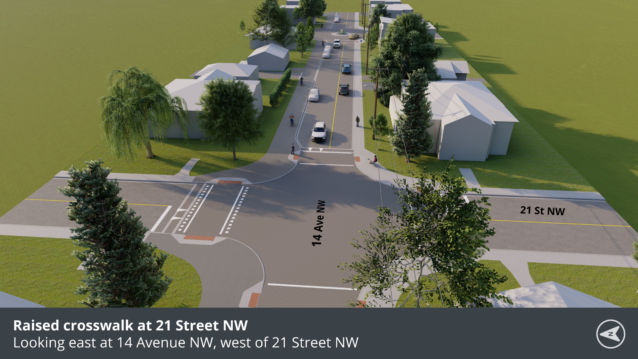
Raised intersection/crossings at 21 Street N.W. slows down drivers and increases visibility of pedestrians crossing.
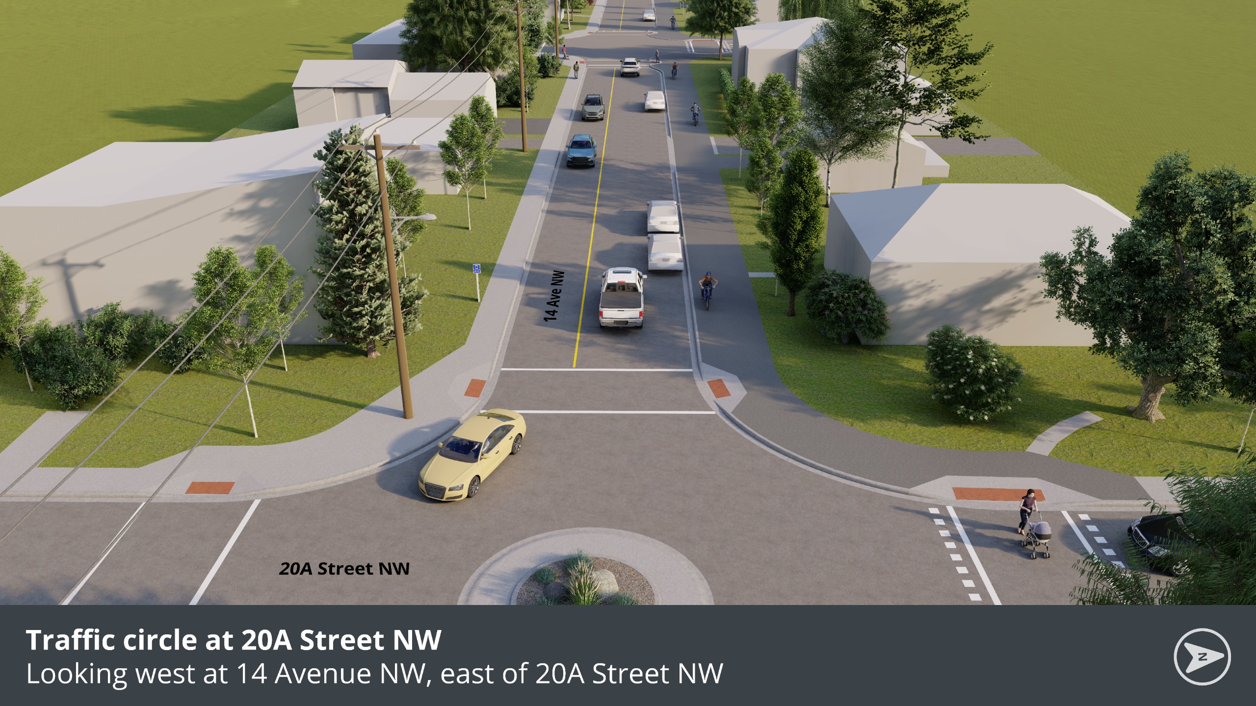
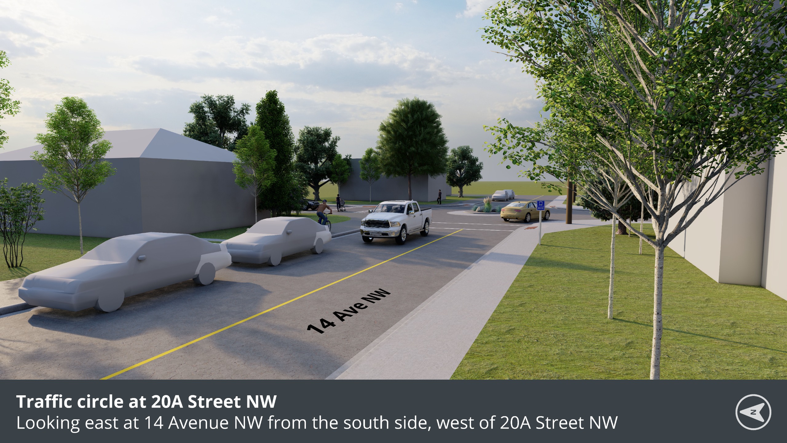
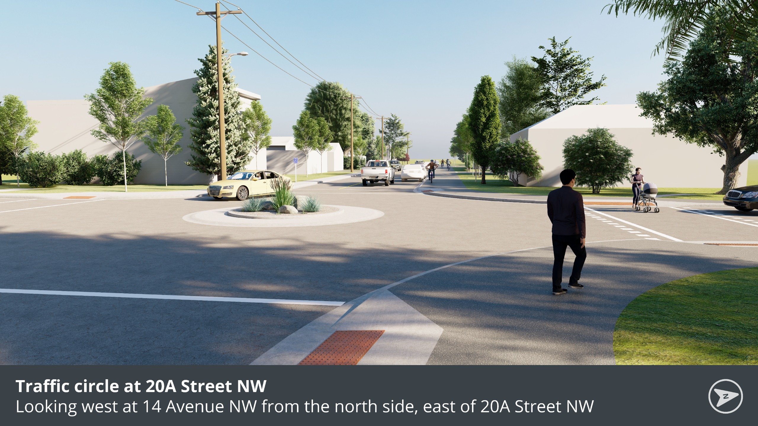
Design aims to retain the existing trees in this section of the corridor. Opportunity for low lying landscaping at the traffic circle on 20A Street N.W.
Design introduces traffic calming measures such as curb extensions, a traffic circle on 20A Street N.W., and a raised intersection at 21 Street N.W.
Existing driveway access will be retained but access may be impacted at times during the construction of the pathway.
The proposed pathway will be slightly wider than the existing sidewalk and is not expected to affect landscaping between the property line and sidewalk. The curb was adjusted to preserve the landscape retaining wall on the north side between 24 St N.W. and the laneway between 23 St N.W. and 22A St N.W. On-street parking was removed in this section to avoid impacting the walls.
Currently vehicles can park on both sides, but this limits effective travel lane width for each direction to approximately 2.5m, which is not up to standard. The new design ensures a consistent travel lane width in each direction of at least 3.0m throughout Segment 1 which adheres to current standards.
Curb extensions are a proven traffic-calming measure that help slow vehicle speeds and improve visibility for people crossing the street. Given the low traffic volumes along this section, these changes are not expected to create traffic issues.
The multi-use pathway would be cleared by The City's pathway maintenance group, with their own priority levels different from the street. Homeowners would still be expected to clear the adjacent 1.5m of snow from the multi-use pathway like they do for the sidewalks.
In the spirit of truth and reconciliation, The City of Calgary acknowledges that we live, work, and play on the ancestral and traditional territory of the Blackfoot Confederacy, made up of the Siksika, Piikani, and Kainai First Nations; the Îethka Nakoda Wîcastabi First Nations, comprised of the Chiniki, Bearspaw, and Goodstoney First Nations; and the Tsuut’ina First Nation. The city of Calgary is also homeland to the Métis Nation Battle River Territory – Nose Hill Métis Region 5 & Elbow River District 6. I acknowledge and give gratitude to the many First Nations, Métis, and Inuit who live here and call Calgary home.
You see the results of decisions made by The City of Calgary every day. Get involved and provide your input on City projects and programs. Together we can build a better city.
Have questions or want to learn more about a project, contact us below:
| Phone | 311 or 403-268-CITY (2489) |
|---|---|
| engage@calgary.ca | |
| Website | www.calgary.ca |


