About the project
Project objectives
- Assess the road classification to determine if the skeletal road designation remains appropriate or if an arterial street (or other) classification is more suitable for the study area.
- Evaluate the previously proposed grade-separated interchange and explore innovative alternatives to balance traffic flow while improving connectivity to adjacent communities and public spaces.
- Recommend short- and long-term improvements to promote safety and connectivity for all road users.
- Confirm land impacts, utility impacts, and noise mitigation strategies.
- Provide capital cost estimates for the recommendations, supporting a flexible future implementation strategy.
Project background
John Laurie Blvd. and McKnight Blvd. between 14 Street NW and Deerfoot Trail, have been identified under the 2020 Calgary Transportation Plan (CTP) as critical arterials.
- The corridor from 14 Street to 4 Street NW, is currently designated as a skeletal road.
- The segment from 4 Street to Deerfoot Trail is classified as an arterial road.
The 2005 planning study included the following recommendations:
- Designating John Laurie Blvd/McKnight Blvd as an 80 km/hr skeletal road
- Implementing grade-separated, free-flow intersections
- Establishing a 5-metre buffer zone between the roadway and adjacent residential areas
Improvements implemented in recent years include blocking the northbound left turn movement (from John Laurie Blvd to 48 Avenue) and extending the left turn bays at McKnight Blvd/4th Street.
Past Community Engagement
- Adjacent communities have raised concerns about safety for pedestrians, school traffic and drivers using the John Laurie Blvd., 48 Avenue NW, McKnight Blvd. intersection.
- Numerous meetings have occurred between City staff and the North Haven and Thorncliffe-Greenview Community Associations in the past several years regarding the intersection.
- The intent of the current Functional Planning Study would be to meet and explore with residents and the public both short- and long-term improvements for the intersection, including any design recommendations.
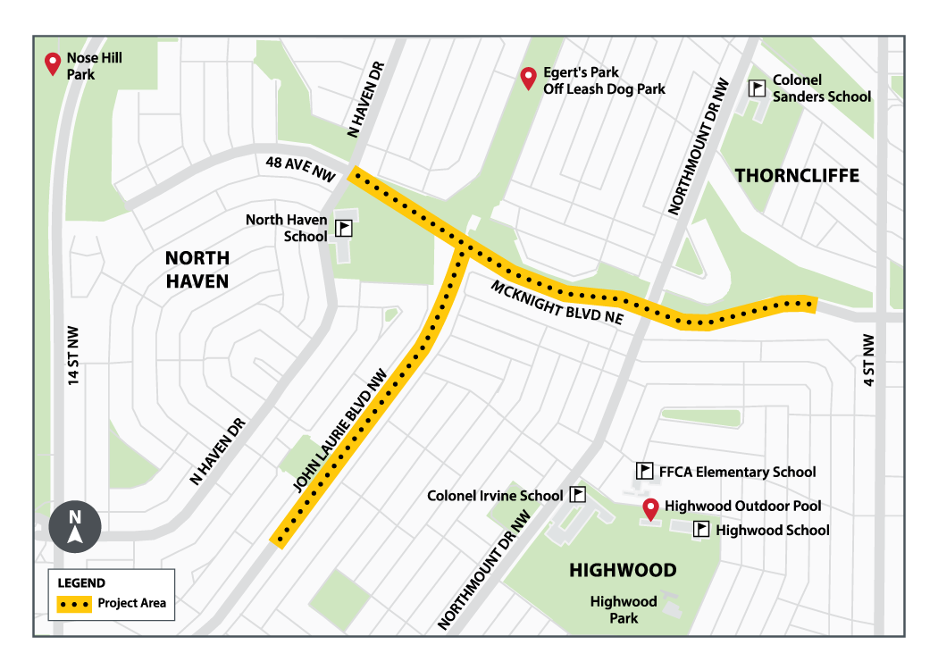
Study area and map