About the project
Project background
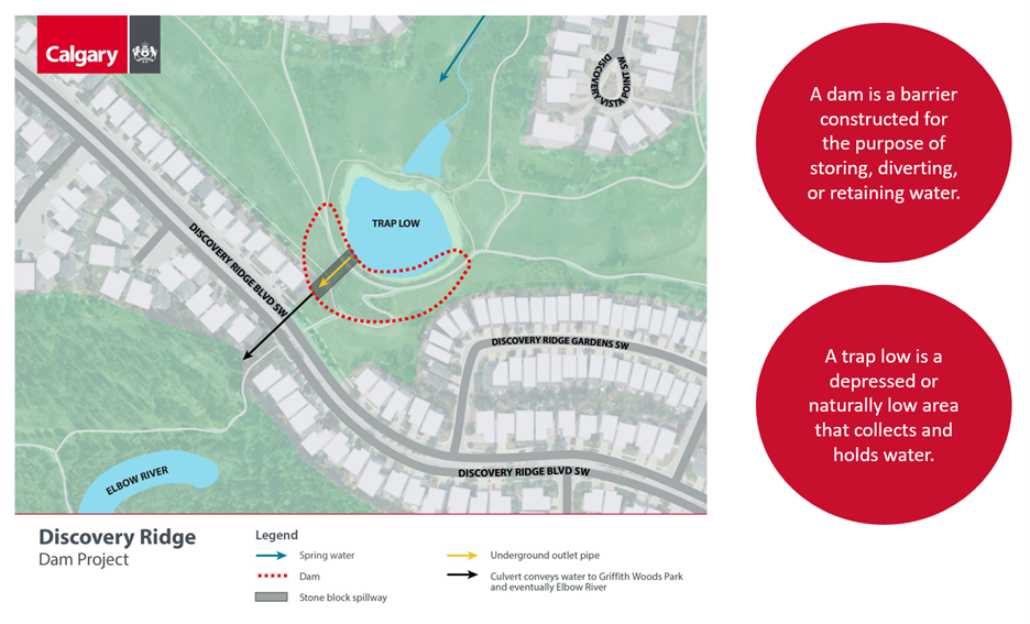
The Discovery Ridge Dam is an earthfill dam that retains water in a pond. The pond, or trap low, collects water from a groundwater spring and local surface runoff. The dam was constructed in the 1950s to retain water for agricultural purposes. When the community was developed in the early 2000s, the dam and pond remained. From the pond, water flows under Discovery Ridge Boulevard through Griffith Woods Park to the Elbow River. There are no stormwater pipes that enter the pond.
Following regulatory changes in recent years, The City completed assessments on the dam. The Dam Safety Review, completed in 2024, outlined several deficiencies with the dam. We took action to address a critical deficiency by lowering the pond's water level in Spring 2024.
The City has since made the decision to remove the dam based on risks to public safety. That said, this is a valuable natural park space, and it will be reimagined with community input in mind.
Project vision
The objective of this project is to address the risk of the dam while restoring natural habitat and ensuring the community has a space to enjoy. We are currently in the conceptual design phase of work. Two concepts have been developed: a natural channel and a wetland system. Bodies of water larger than these concepts are not possible with the requirement to remove the dam. Both concepts allow water to flow naturally through the area while meeting the project's technical requirements.
Project information
The figure below outlines the different elements of the current space, including the extents of the existing dam and flow of water through the space, from the start of the groundwater spring to the outlet of water into Griffith Woods Park and eventually the Elbow River.
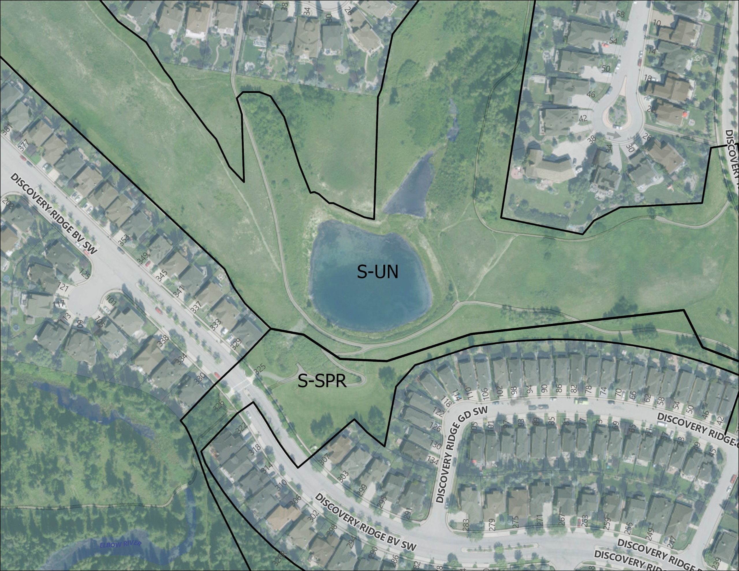
The majority of this space’s land use designation is Special Purpose – Urban Nature (S-UN). Urban Nature land uses reflect natural landforms and vegetation and facilitates passive recreational use (eg. walking). The purpose of this space is to protect natural landscapes and ecology, support plants and animals and manage water naturally. This area will remain a natural area in the new design of the space.
A smaller portion of the space, closer to Discovery Ridge Boulevard is designated as Special Purpose – School, Park, Community Reserve (S-SPR). A portion of the space in this land use area is mown manicured grass currently.
Please click on the images to expand them in a new tab.
The images below show the evolution of the space from before the dam was built to today’s condition.
1948 – Prior to the dam being built with natural drainage to the Elbow River
1957 – First aerial showing pond and dam for agricultural purposes
2003 – Early 2000s the community is developed around the body of water
2024 – Today’s established community

The City has held information sessions to share updates and explain the project in recent months. Content from these information sessions is provided below.
- November 20, 2025: Information session to provide an update on the project status and next steps. Content from the information session can be downloaded here: November 2025 Info Session Powerpoint
- January 29, 2026: Technical information session to review reports that informed decision making around the dam removal. Content from the information session can be downloaded here: January 2026 Technical Info Session Powerpoint
Survey below
Share your thoughts on the proposed ideas. This survey should take about 5 minutes to complete.


