Phase 1: ENVISION
Develop Vision and Core Principles
Phase 1 was open from April 6 - April 27, 2026. Click on the button below to see the Phase 1 content and questions.
Over the next two years, The City of Calgary (The City) will work closely with landowners, area residents, and developers to create an Area Structure Plan (ASP) for the unplanned South Belvedere area. When we plan for new communities, we plan for clear, fair, and transparent development of new homes, businesses, and services.
Your insights and involvement will help us create a plan that reflects shared priorities and the unique opportunities in the South Belvedere area.
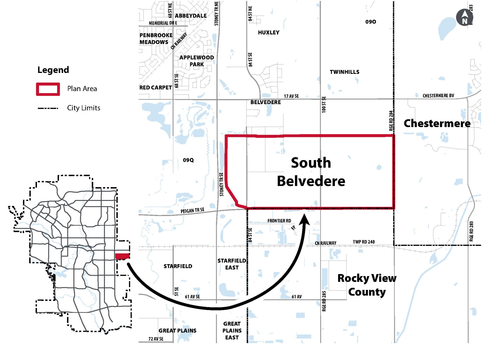
South Belvedere lands are currently without an approved area structure plan. Lots of people are moving in, building homes and starting businesses in the Belvedere Area immediately to the North of these lands, showing a strong desire to live and work in the area.
A new plan will ensure that the development of more homes, businesses, and services in this area is predictable, fair, and efficient.
South Belvedere area is close to downtown, easy to get to from Stoney Trail S.E., and near major existing employers and services. Additionally:
South Belvedere is east of Downtown Calgary and Stoney Trail. It is next to the Belvedere community on the north, Peigan Trail S.E. on the south, Range Road 284 on the east, and Stoney Trail S.E. on the west. Currently, the area has small and medium farms and rural homes.
The plan area is 588 hectares (1,453 acres) slightly larger than 2 farm sections. There are about 78 registered landowners. South Belvedere lands are next to The City of Chestermere and Rocky View County.
Click on the questions below to read the answers to each.
Area structure plans are developed through a phased engagement process. Public Engagement for the project occurs during Phase 1, Phase 2, and Phase 3. In Phase 4 the project will go before Committee and Council.
Develop Vision and Core Principles
Draft Land Use Concept and formulate policy that outlines where growth and development can happen.
Fall 2026 - Winter 2027
Refine the Land Use Concept and Policy based on inputs
Summer 2027
Committee and Council review and decision.
Winter 2028
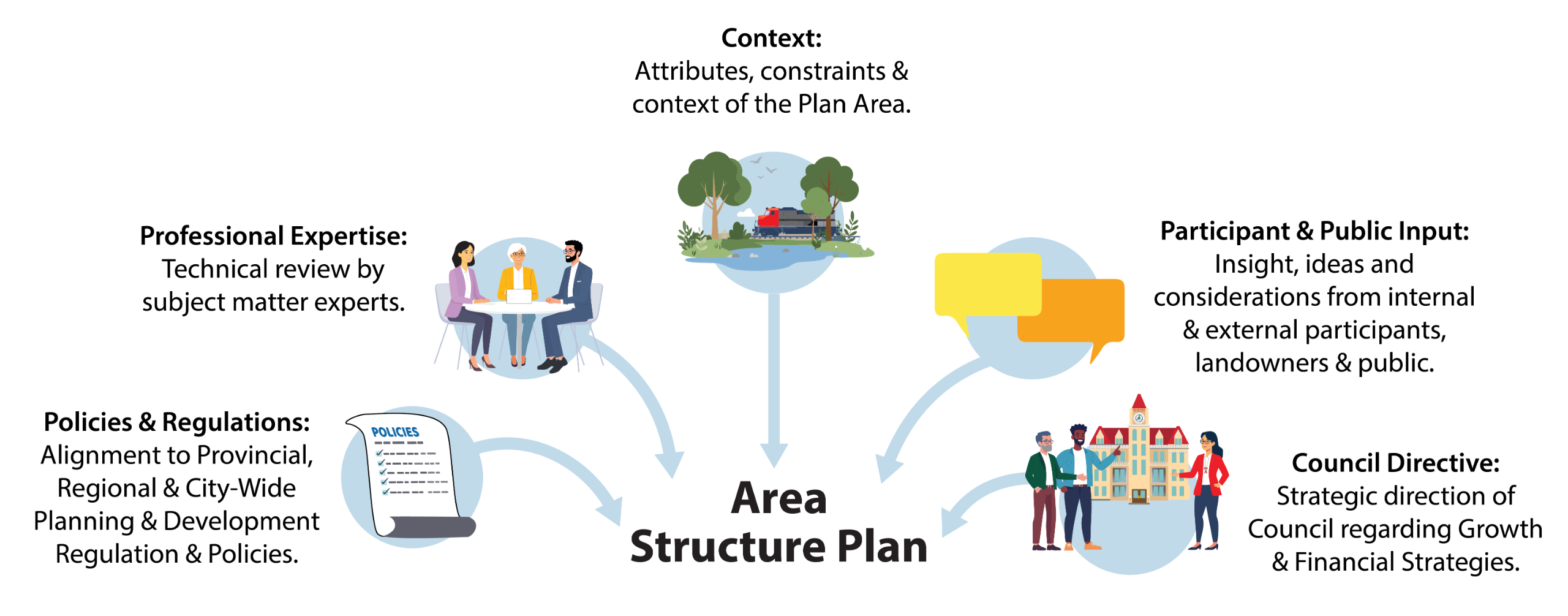
The creation of a new ASP allows people living in the area, landowners, and anyone interested in the community’s future to have a say in how the South Belvedere lands will be developed.
Your input matters. It helps us understand potential impacts, opportunities, and insights for the plan. The input we receive is then balanced with City policies, professional expertise, and best practices to create a well‑informed and comprehensive area structure plan.
In the spirit of truth and reconciliation, The City of Calgary acknowledges that we live, work, and play on the ancestral and traditional territory of the Blackfoot Confederacy, made up of the Siksika, Piikani, and Kainai First Nations; the Îethka Nakoda Wîcastabi First Nations, comprised of the Chiniki, Bearspaw, and Goodstoney First Nations; and the Tsuut’ina First Nation. The city of Calgary is also homeland to the Métis Nation Battle River Territory – Nose Hill Métis Region 5 & Elbow River District 6. I acknowledge and give gratitude to the many First Nations, Métis, and Inuit who live here and call Calgary home.
You see the results of decisions made by The City of Calgary every day. Get involved and provide your input on City projects and programs. Together we can build a better city.
Have questions or want to learn more about a project, contact us below:
| Phone | 311 or 403-268-CITY (2489) |
|---|---|
| engage@calgary.ca | |
| Website | www.calgary.ca |


