ABOUT THE PROJECT
As part of the Neighbourhood Streets Program, The City is working with the community of Dover to improve streets in the neighbourhood and create an inclusive mobile network for all community residents.
Please share your perspective on the design work in the community of Dover for walking, wheeling, and placemaking.
This project includes:
- Creating a walking, cycling, and wheeling connection through the community of Dover
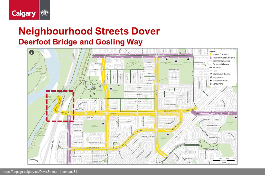
- Addressing speed and design issues on 34 Avenue SE
- Providing important connections to existing pathways and bikeways
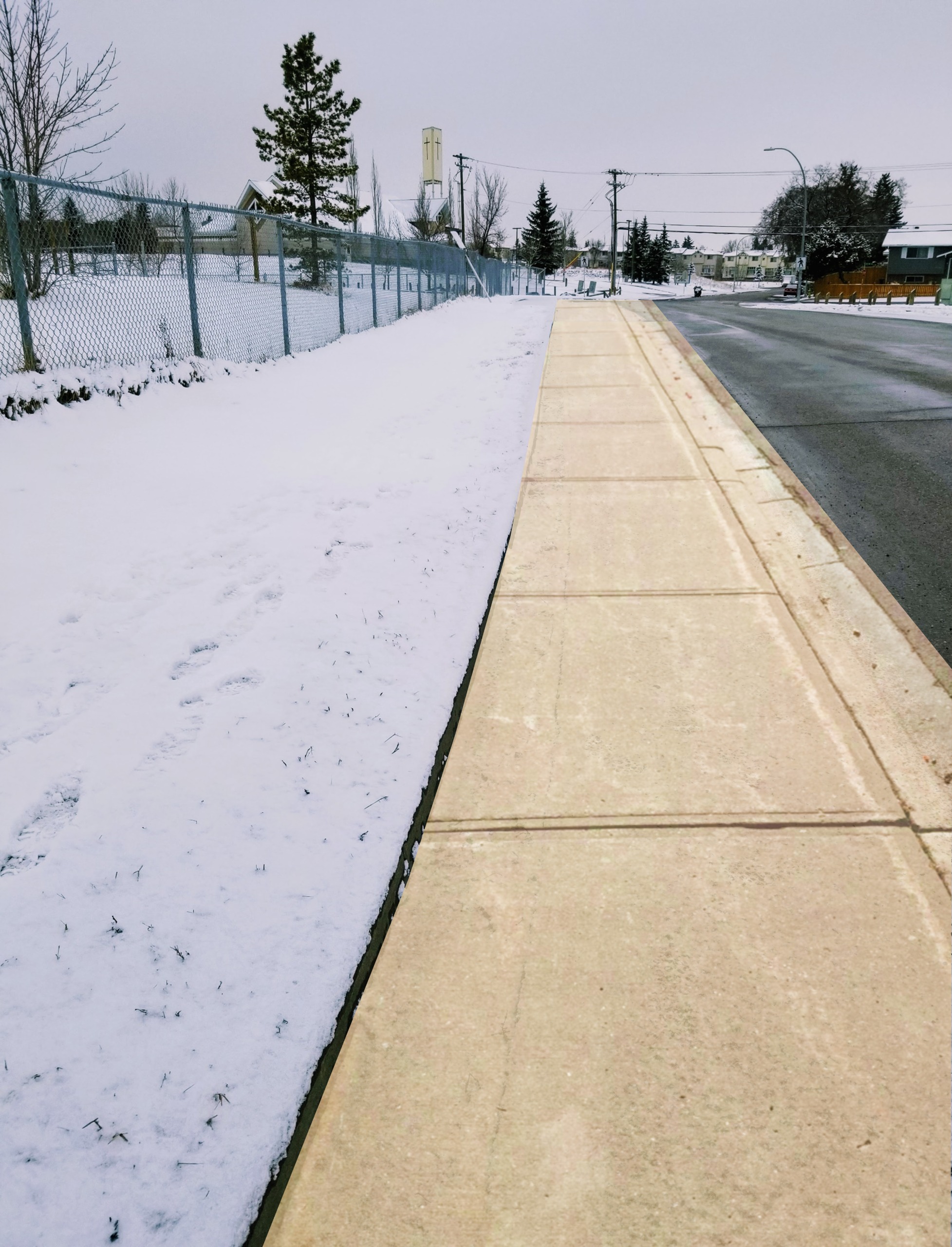
- Installing missing sidewalks
- Providing connections to schools and parks
PROJECT UPDATE- January 2023
Happy New Year! We are happy to announce that we have received $1.3 million in funding from the Government of Canada’s Active Transportation Fund for the Dover Neighbourhood Streets project. This means that we will be able to move forward with more improvements to the community. Dover streets will become more accessible to people of all ages and abilities, whether they walk or wheel. These improvements will help safely connect residents to the Bow River pathway, shops, schools and more.
PROJECT UPDATE- June 2022
Thank you to the many Dover residents and visitors who helped share information on how they feel traveling in different parts of the community, and helped identify preferred concepts to create an inclusive, safe mobile network. View the What We Heard Report to learn more.
Due to general support of this project and time constraints with coordinated federal and municipal funding, no additional public engagement will be conducted on this project. We are pursuing funding for Phase 2 design of 34 Avenue S.E. and the other corridors and will provide an update when funding and resourcing is confirmed. You can always contact us through 311 or by emailing the project team.
Mobility
Mobility includes:
|
|

UPDATE: Q&A PRESENTATION VIDEO

Together, these projects create a safe and comfortable walking and wheeling network for kids, families, and Dover residents of all ages and abilities.
We are looking for your help in determining a preferred design for 34 Avenue/Gosling Way. We are also looking for feedback on how all designs can be improved to make walking and wheeling in and through Dover a more safe, comfortable and convenient experience. The designs are independent of one another, so we can choose to implement one, some, or all depending on feedback we receive from the community.
For added background please use the tabs below to access a glossary of terms and past engagement questions. There is also a pdf version of concept designs available in the links section on this page.
Glossary
Sometimes known as ‘quiet streets’, ‘slow streets’ and ‘bicycle boulevards’, Neighbourhood Greenways are Residential streets with low volumes of vehicle traffic and low speeds where people cycling and walking are given priority, and feature pavement markings, signs, and traffic calming elements to keep traffic moving slower. This creates a pleasant, more comfortable cycling environment for less experienced or confident riders without requiring specific cycle facilities.
These will include space for people walking and wheeling side-by-side. These create key connections between community amenities like schools, parks, playgrounds, etc.
This is a general term that describes a set of different practices focused on slowing down vehicle traffic. Typically this involves using physical devices constructed on a roadway such as speed humps, traffic circles, directional road closures and may include regulatory changes such as turn prohibitions. In addition, traffic calming can incorporate opportunities for community gathering, art, seating, and other ways to improve the community.
Curb extensions visually and physically narrow a roadway. Along a section of a road a curb extension may be placed to slow down a vehicle traveling along the corridor. At intersections, curb extensions have a twofold benefit of slowing down vehicles while creating a safer and shorter crossing for pedestrians.
Diagonal diverters are raised medians, bollards (posts) or planters, or another type of treatment placed diagonally in the middle of a four-way intersection to allow traffic circulation while reducing vehicle speeds and cut-through traffic.
Diagonal diverters are placed at low volume four-way intersections. Instead of a stop sign or an uncontrolled intersection, people driving are only able to turn one way, which helps to reduce vehicle speeds and cut-through traffic. Space is maintained for people walking or wheeling (riding a bike, skateboard, scooter or mobility device) to safely pass through.
Phase 2: Concepts
During Phase 1 engagement we heard that including improving east-west and north-south connectivity in the community was important. We also heard about several missing bicycle and pedestrian links, as well as accessibility challenges. Safety, connectivity, improved amenities, including park spaces were mentioned frequently.
Based on this input, a network of Neighbourhood Greenways became apparent. Neighbourhood Greenways are also known ‘slow streets’ and ‘bicycle boulevards’. They have lower volumes of vehicle traffic and lower speeds, include pavement markings, signs, and traffic calming elements to create a comfortable and pleasant environment for those walking and wheeling while maintaining spaces for vehicles.
Preliminary concepts for Neighbourhood Greenways have been developed for:
Past Engagement
- Missing sidewalks: Where you would like to see new sidewalks added?
- Traffic calming: Where you would like to see safety measures that reduce speed and the number of vehicles driving on a street?
- Pathways and protected lanes: Where you would like to see new off-street pathways and on-street protected lanes for walking and wheeling?
- Community art: Where you would like to see colourful benches, wall/fence artwork or other improvements, street pavement murals, community signage, and more?
- Street trees: Where you would like to see more trees in the streetscape? Do you have a preference for any particular type of tree?
- Accessibility: Are there any barriers to accessibility that you have noticed? Do you have any suggestions for improvements?


*Traffic calming image courtesy of: Paul Krueger.
PROVIDE YOUR INPUT - survey is now closed thank you for your time and input.
We have developed designs that seeks to increase safety, comfort, and convenience for those traveling on foot, by bike, or by car.
- Safety refers to reducing the number of collisions
- Comfort refers to the ease of travel for those on foot, on bike, on transit, or in a car
- Convenience refers to making all modes of travel (walking, cycling, transit, or driving) easy to use.
Please answer the following questions related to the five intersections below. The survey should take 5-10 minutes of your time. We have provided maps and concept designs to hopefully add clarity to the concepts and questions. You do not need to comment on all sections but please remember to hit the submit button at the end of survey section.
Thank you in advance for your time and input.