
Engagement for this project is now closed. For more information about the project and implementation, please visit Calgary.ca/Plus15Wayfinding
ABOUT THE PROJECT
What is the Plus 15 Wayfinding Project?
The City and its partners operate the Plus 15 network in downtown Calgary. This includes 86 bridges and over 16 km of elevated walkways that connect over 100 buildings.
This network is well-used by people who live, work, and visit downtown, but it can be a confusing place to navigate. A clear wayfinding system will make it easier to use the Plus 15 network, attracting more people and creating a better overall experience. Modernizing the Plus 15 wayfinding system will help to integrate the Plus 15 network with transit and street-level amenities, which will support Calgary’s downtown and local businesses.
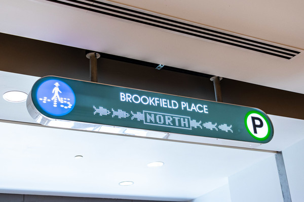
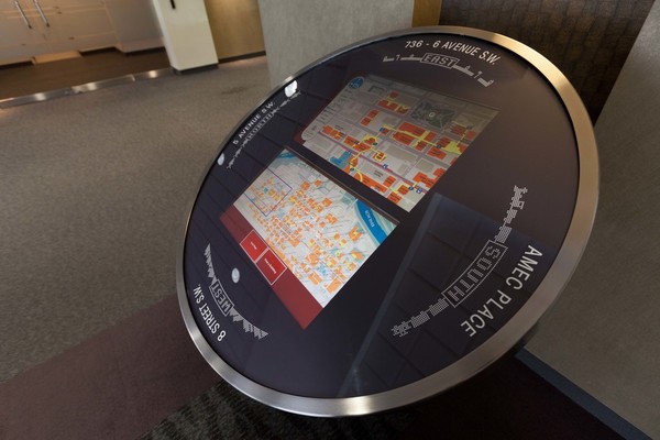


The current state of wayfinding signage on the Plus 15 (2021).
BACKGROUND
The development of a comprehensive, holistic, and clear wayfinding system that makes it easier for Calgarians and visitors to access and navigate the Plus 15 network is supported by over a decade of Centre City policy, including:
- 2007 Centre City Plan
- 2009 Calgary Downtown Retail District Strategy
- 2015 Centre City Urban Design Guidelines
- 2017 Access Design Standards
- 2019 Plus 15 Network Study
- 2021 Calgary's Greater Downtown Plan
The 2019 Plus 15 Network Study examined concerns with the existing Plus 15 Network wayfinding system and recommended areas of improvement:
1. Clarity and Consistency of Brand Message: It was recommended that the Plus 15 network undergo a detailed audit of the current brand, and, that further work be done to create a stronger and more effective brand that reflects the goals of the Plus 15 network. Appropriate logo, font, and colour testing should be done to ensure the program is refined to be easily recognizable in all environments and appealing to the intended audience. Guidelines should be developed to allow third party users to follow set standards for Plus 15 network representation on their building’s signage and directories to ensure consistency. Communication requirements for accessibility issues should also be built into the brand standards.
2. Maps: It was recommended that the map be refined to be more schematic and easier to read at a glance, with fonts and colours that visually connect to the logo and other brand assets.
3. Awareness/Visibility: It was recommended that a holistic approach to wayfinding design and placement be developed to ensure continuity of the user experience and understanding throughout the entire Plus 15 network
ENGAGEMENT: PHASE 1
Plus 15 Pin Map
Thank you to everyone who provided input on the map during March and April 2021. The Plus 15 Network is shown in purple below. The coloured pins show the comments people added at specific locations. Use the + and – buttons to zoom on the map and click on the pins to see the comments.
- Red pin - barriers to accessibility
- Orange pin - issues with navigation
- Green pin - a ‘don’t-miss’ destination, somewhere you would take a visitor
- Blue pin - a memorable landmark, like the Suncor Centre airplane for example
- Brown pin - other locations
No changes have been made to people's comments but comments with profanity, phone numbers or email addresses were removed. It is important to remember that each submission will be visible to everyone so we strongly advise that people do not include personal identifying information.
Comments are moderated to ensure a productive and respectful environment for everyone.


